| P number: | P002542 |
|---|---|
| Old photograph number: | C03910 |
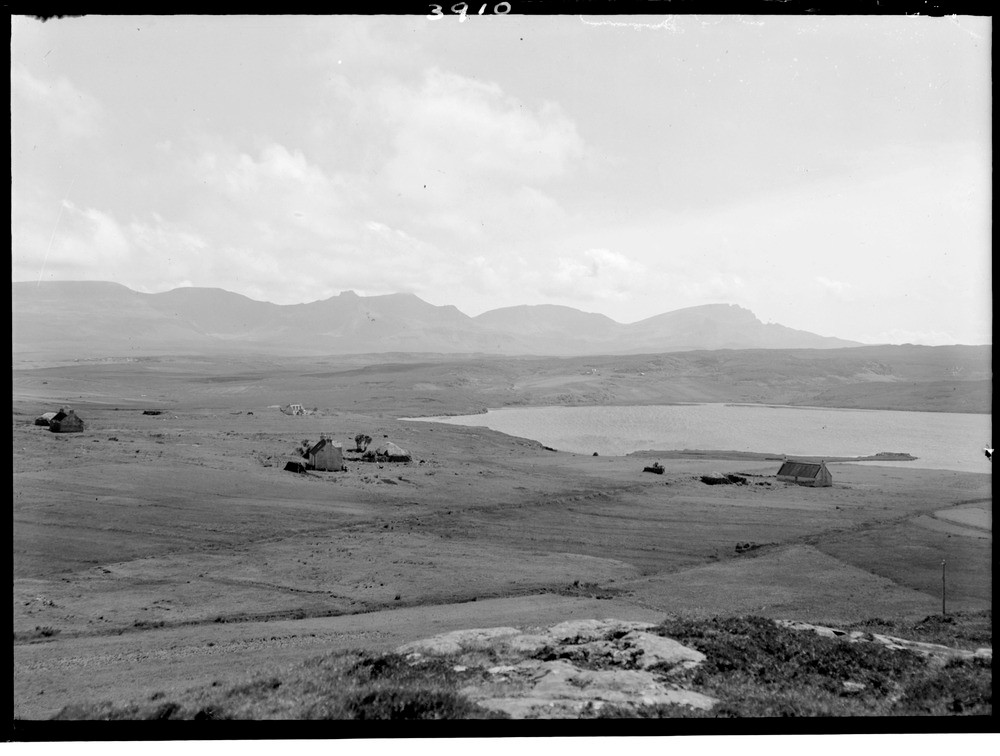
| Caption: | Creag a' Lain, and The Storr, looking south-west from Elishader, Loch Mealt in foreground, Trotternish peninsula, Skye, Inverness-shire. Escarpments of Tertiary lavas with Jurassic sediments and associated intrusive sills of dolerite in foreground. |
| Description: | Creag a' Lain, and The Storr, looking south-west from Elishader, Loch Mealt in foreground, Trotternish peninsula, Skye, Inverness-shire. Escarpments of Tertiary lavas with Jurassic sediments and associated intrusive sills of dolerite in foreground. Part of the Tertiary escarpment on the east side of the Trotternish peninsula from Ben Tianavaig to the south of Portree Bay to Sron Vourlinn above Flodigarry that has undergone landslipping. The Storr landslip is the best known and most spectacular of the Skye landslips. It stretches 5000 feet almost to the coast over the Jurassic and dolerite sills. It is thought to be entirely post-glacial and its volume and extent is consistent with a pre-slip escarpment about 2000 feet to the east of its present position. |
| Date taken: | Mon Jan 01 00:00:00 BST 1945 |
| Photographer: | Fisher, W.D. |
| Copyright statement: | Crown |
| Acknowledgment: | This image was digitized with grant-in-aid from SCRAN the Scottish Cultural Resources Access Network |
| X longitude/easting: | 150500 |
| Y latitude/northing: | 865500 |
| Coordinate reference system, ESPG code: | 27700 (OSGB 1936 / British National Grid) |
| Orientation: | Landscape |
| Size: | 140.13 KB; 1000 x 756 pixels; 85 x 64 mm (print at 300 DPI); 265 x 200 mm (screen at 96 DPI); |
| Average Rating: | Not yet rated |
| Categories: | Unsorted Images |
Loading...
Loading...
Reviews
There is currently no feedback