| P number: | P002538 |
|---|---|
| Old photograph number: | C03904 |
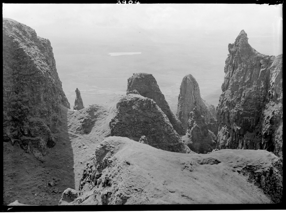
| Caption: | Within the Quiraing landslip, from The Table, Trotternish peninsula, Skye, Inverness-shire. Detail of the shattering of the Tertiary lava escarpment due to landslipping. |
| Description: | Within the Quiraing landslip, from The Table, Trotternish peninsula, Skye, Inverness-shire. Detail of the shattering of the Tertiary lava escarpment due to landslipping. This now mature and on the whole stable landslip is thought to have formed after the last glaciation and prior to the late-glacial readvance. It is thought that a pre-glacial slip would have extended seawards from a scarp 3000 feet east of the present position and have an altitude of at least 2500 feet but has been removed by the Highland ice. The toe of this slip must have extended as far as Flodigarry and Staffin Island. The present slip formed due to the favourable conditions caused by the removal of the ice. |
| Date taken: | Mon Jan 01 00:00:00 BST 1945 |
| Photographer: | Fisher, W.D. |
| Copyright statement: | Crown |
| Acknowledgment: | This image was digitized with grant-in-aid from SCRAN the Scottish Cultural Resources Access Network |
| X longitude/easting: | 145500 |
| Y latitude/northing: | 869500 |
| Coordinate reference system, ESPG code: | 27700 (OSGB 1936 / British National Grid) |
| Orientation: | Landscape |
| Size: | 200.96 KB; 1000 x 756 pixels; 85 x 64 mm (print at 300 DPI); 265 x 200 mm (screen at 96 DPI); |
| Average Rating: | Not yet rated |
| Categories: | Unsorted Images |
Loading...
Loading...
Reviews
There is currently no feedback