| P number: | P002517 |
|---|---|
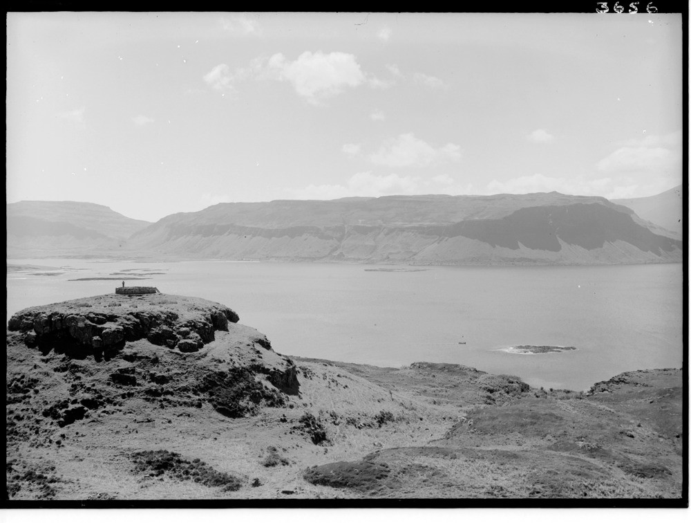
| Old photograph number: | C03656 |
| Caption: | Panorama from north of Dun Bhioramuill, Ulva, Argyllshire. |
| Description: | Highest ground on left is Ben More with a three centre igneous complex to the east. Cliffs at Gribun in centre are plateau basalts as are the rocks in the forground on Ulva. On the right is the continuation of the plateau basalts which were erupted onto the eroded surface of the Mesozoic sedimentary strata below. The island of Inch Kenneth formed of Trias. The sequence of activity on Mull is broadly similar to the other central complexes. Activity began with the eruption of basaltic lavas fed from north-west - south-east fissures in a 2.2 km. thick lava pile. Later lavas coincided with the Glen More Centre, Centre 1 typified by a large caldera lake and ring dyke formation. The Beinn Chaisgidle (Centre 2) and Loch Ba (Centre 3) centres followed both with acid and basic intrusions though in Centre 3 granitic rocks predominate. Looking east and south across Loch na Keal towards the Tertiary central igneous complex of Mull and surrounding plateau basalts. Part of a panorama with C03655 and C03657. The description is for the full panorama. |
| Date taken: | Fri Jan 01 00:00:00 GMT 1937 |
| Photographer: | Fisher, W.D. |
| Copyright statement: | Crown |
| Acknowledgment: | This image was digitized with grant-in-aid from SCRAN the Scottish Cultural Resources Access Network |
| X longitude/easting: | 143500 |
| Y latitude/northing: | 738500 |
| Coordinate reference system, ESPG code: | 27700 (OSGB 1936 / British National Grid) |
| Orientation: | Landscape |
| Size: | 150.31 KB; 1000 x 756 pixels; 85 x 64 mm (print at 300 DPI); 265 x 200 mm (screen at 96 DPI); |
| Average Rating: | Not yet rated |
| Categories: | Unsorted Images |
Loading...
Loading...
Reviews
There is currently no feedback