| P number: | P002495 |
|---|---|
| Old photograph number: | C03508 |
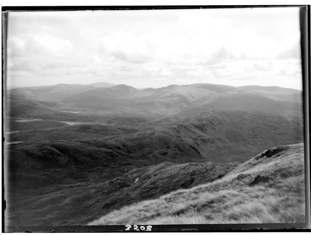
| Caption: | View from summit of The Merrick, Kirkudbrightshire. Part of a panoramic view of Galloway 'granite country'. Part of a panorama with C03507. Description is for the whole panorama. |
| Description: | View from summit of The Merrick, Kirkudbrightshire. Part of a panoramic view of Galloway 'granite country'. Part of a panorama with C03507. Description is for the whole panorama. Panoramic view of the Loch Doon granite pluton (south end) with the ice-gouged Loch Neldriken in foreground. The early Devonian Loch Doon granite formed the centre of accumulation for the local ice-cap during the Devensian glaciation. The Merrick is the highest point in Scotland south of the Highlands. It is only one peak on a range of hills which together form an elevated ring of hornfelsed (baked) greywackes almost completely surrounding the Loch Doon pluton. These hornfelsed rocks are evidently more resistant to erosion than the granodiorite, which tends to form lower ground with lochs. |
| Date taken: | Wed Aug 01 00:00:00 BST 1934 |
| Photographer: | Fisher, W.D. |
| Copyright statement: | Crown |
| Acknowledgment: | This image was digitized with grant-in-aid from SCRAN the Scottish Cultural Resources Access Network |
| X longitude/easting: | 242500 |
| Y latitude/northing: | 585500 |
| Coordinate reference system, ESPG code: | 27700 (OSGB 1936 / British National Grid) |
| Orientation: | Landscape |
| Size: | 144.85 KB; 1000 x 756 pixels; 85 x 64 mm (print at 300 DPI); 265 x 200 mm (screen at 96 DPI); |
| Average Rating: | Not yet rated |
| Categories: | Unsorted Images, Geoscience subjects/ General views/ Igneous rock country |
Loading...
Loading...
Reviews
There is currently no feedback