| P number: | P002461 |
|---|---|
| Old photograph number: | C03109 |
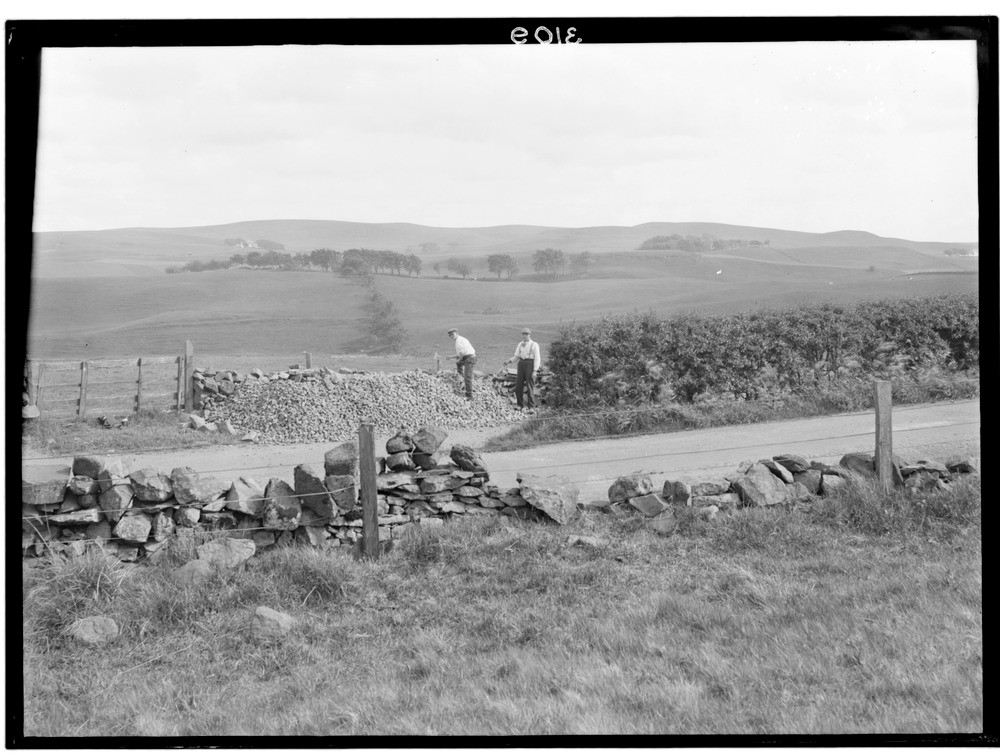
| Caption: | Greenhags, 4.0 km. south-west of Newton Mearns, Renfrewshire. Lava flow topography. |
| Description: | Greenhags, 4.0 km. south-west of Newton Mearns, Renfrewshire. Lava flow topography. Undulating hilly country formed of successive flows of Carboniferous age lavas of the Clyde Plateau Volcanic Formation, Strathclyde Group. The glaciation over the last 100,000+ years has also moulded and smoothed the surfaces of the lavas giving soils well suited for pasture. The Midland Valley of Scotland was quite active volcanically during the early Carboniferous period, with huge volumes of basalt lava erupted, especially in the western part of the Midland Valley. Numerous contemporary basic and intermediate intrusions such as dykes, sills and plugs pierce the older sedimentary rocks. |
| Date taken: | Fri Jan 01 00:00:00 GMT 1926 |
| Photographer: | Manson, W. |
| Copyright statement: | Crown |
| Acknowledgment: | This image was digitized with grant-in-aid from SCRAN the Scottish Cultural Resources Access Network |
| X longitude/easting: | 253500 |
| Y latitude/northing: | 655500 |
| Coordinate reference system, ESPG code: | 27700 (OSGB 1936 / British National Grid) |
| Orientation: | Landscape |
| Size: | 194.48 KB; 1000 x 756 pixels; 85 x 64 mm (print at 300 DPI); 265 x 200 mm (screen at 96 DPI); |
| Average Rating: | Not yet rated |
| Categories: | Unsorted Images, Geoscience subjects/ General views/ Igneous rock country |
Loading...
Loading...
Reviews
There is currently no feedback