| P number: | P002450 |
|---|---|
| Old photograph number: | C03087 |
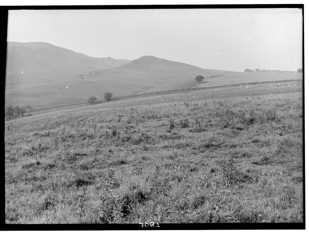
| Caption: | Near Knockgardner, 3.2 km. west 30 degrees south of Straiton, looking south-west, Ayrshire. |
| Description: | Near Knockgardner, 3.2 km. west 30 degrees south of Straiton, looking south-west, Ayrshire. From left to right: the fault scarp of steep Lower Old Red Sandstone sediments: the fault hollow; Green Hill of Knockgardner, an intrusion of quartz-dolerite in Blair and Straiton Group (Silurian); on the extreme right Knockgardner Farm (on skyline) stands on a low feature formed by flat Upper Old Red Sandstone unconformable on folded Silurian. |
| Date taken: | Fri Jan 01 00:00:00 GMT 1926 |
| Photographer: | Manson, W. |
| Copyright statement: | Crown |
| Acknowledgment: | This image was digitized with grant-in-aid from SCRAN the Scottish Cultural Resources Access Network |
| X longitude/easting: | 235500 |
| Y latitude/northing: | 603500 |
| Coordinate reference system, ESPG code: | 27700 (OSGB 1936 / British National Grid) |
| Orientation: | Landscape |
| Size: | 235.76 KB; 1000 x 756 pixels; 85 x 64 mm (print at 300 DPI); 265 x 200 mm (screen at 96 DPI); |
| Average Rating: | Not yet rated |
| Categories: | Unsorted Images, Geoscience subjects/ Structural features/ Fault scarps |
Loading...
Loading...
Reviews
There is currently no feedback