| P number: | P002399 |
|---|---|
| Old photograph number: | C02780 |
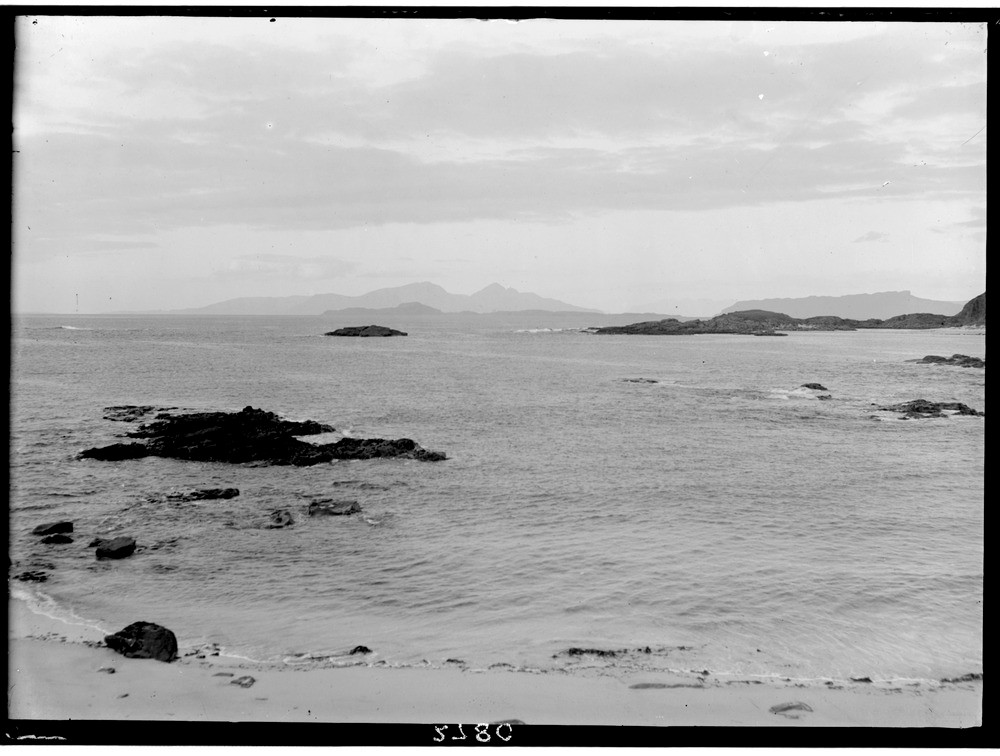
| Caption: | View of Inner Hebrides looking north from Ardnamurchan, Argyllshire. |
| Description: | The islands are all part of a major Tertiary volcanic district. Formed during a period of intense and prolonged igneous activity that marked the start of the Tertiary era the volcanicity extended over a period of eleven million years from c. 63 Ma. to c. 52 Ma. It started with the accumulation of thick sequences of basaltic lava as seen on Canna and Muck followed by the development of the major central volcanoes which include those of Ardnamurchan, Rum and the Cuillins. Rum lies to the left, against skyline, with Muck in front. The Sgurr of Eigg is to the right. Between Rum and Eigg the more distant Cuillin Hills of Skye are just visible. The headland to the left of Rum is a portion of Canna. |
| Date taken: | Sat Jan 01 00:00:00 GMT 1921 |
| Photographer: | Manson, W. |
| Copyright statement: | Crown |
| Acknowledgment: | This image was digitized with grant-in-aid from SCRAN the Scottish Cultural Resources Access Network |
| X longitude/easting: | 141500 |
| Y latitude/northing: | 767500 |
| Coordinate reference system, ESPG code: | 27700 (OSGB 1936 / British National Grid) |
| Orientation: | Landscape |
| Size: | 146.87 KB; 1000 x 756 pixels; 85 x 64 mm (print at 300 DPI); 265 x 200 mm (screen at 96 DPI); |
| Average Rating: | Not yet rated |
| Categories: | Unsorted Images, Geoscience subjects/ Landforms, marine/ Headlands and islands |
Loading...
Loading...
Reviews
There is currently no feedback