| P number: | P002370 |
|---|---|
| Old photograph number: | C02518 |
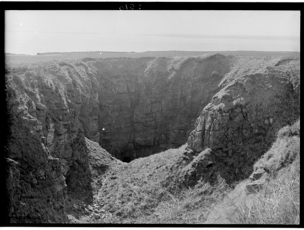
| Caption: | The Gaylet Pot, 4.0 km. north-east of Arbroath, Angus. A 'gloup' or blowhole, the collapsed roof of a cave eroded along joints in the Lower Old Red Sandstone (Lower Devonian) opening at the foot of a sea cliff, a distance of over 137 m. |
| Description: | The Gaylet Pot, 4.0 km. north-east of Arbroath, Angus. A 'gloup' or blowhole, the collapsed roof of a cave eroded along joints in the Lower Old Red Sandstone (Lower Devonian) opening at the foot of a sea cliff, a distance of over 137 m. This vertical hole is formed from the collapse of the inner end of a sea cave. Incoming waves and rising tide forcibly compressing the air along a line of weakness, in this case a joint. This initially forms a cave, repeated compressing at the end of the cave causes concentrated erosion along and up the joint until it breaks though to the surface as in the photograph. This can be a considerable distance inland. |
| Date taken: | Wed Jan 01 00:00:00 GMT 1919 |
| Photographer: | Lunn, R. |
| Copyright statement: | Crown |
| Acknowledgment: | This image was digitized with grant-in-aid from SCRAN the Scottish Cultural Resources Access Network |
| X longitude/easting: | 367500 |
| Y latitude/northing: | 743500 |
| Coordinate reference system, ESPG code: | 27700 (OSGB 1936 / British National Grid) |
| Orientation: | Landscape |
| Size: | 215.34 KB; 1000 x 756 pixels; 85 x 64 mm (print at 300 DPI); 265 x 200 mm (screen at 96 DPI); |
| Average Rating: | Not yet rated |
| Categories: | Unsorted Images, Geoscience subjects/ Landforms, marine/ Influence of structure, composition, faults, joints and dip, Geoscience subjects/ Landforms, marine/ Caves, blowholes, inlets |
Loading...
Loading...
Reviews
There is currently no feedback