| P number: | P002368 |
|---|---|
| Old photograph number: | C02515 |
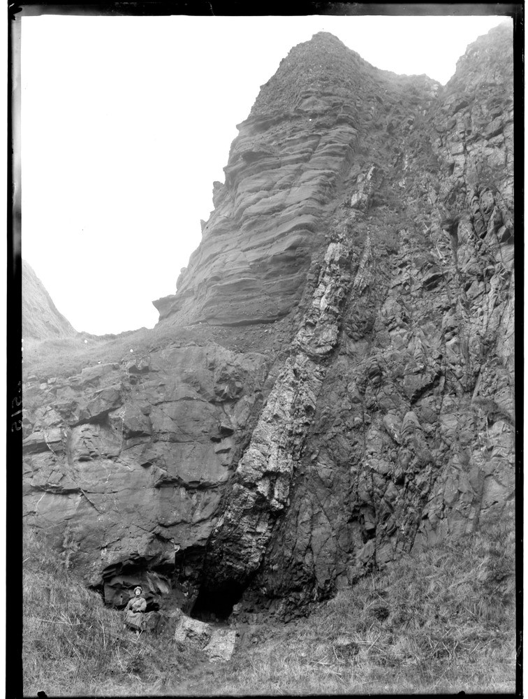
| Caption: | North side of Carlingheugh Bay, 3.2 km. north-east of Arbroath, Angus. The barytes vein filling the fault line between the Lower Old Red Sandstone and Upper Old Red Sandstone, (Lower and Upper Devonian respectively). |
| Description: | North side of Carlingheugh Bay, 3.2 km. north-east of Arbroath, Angus. The barytes vein filling the fault line between the Lower Old Red Sandstone and Upper Old Red Sandstone, (Lower and Upper Devonian respectively). Barytes, (Barium Sulphate BaSO4) is the most common barium mineral, occurring mainly as a gangue mineral in metalliferous hydrothermal veins but as here, in veins or fault-related cavity filling in sandstones. The difference in weathering of the Lower and Upper Old Red Sandstone rocks either side of the fault is clearly visible. |
| Date taken: | Wed Jan 01 00:00:00 GMT 1919 |
| Photographer: | Lunn, R. |
| Copyright statement: | Crown |
| Acknowledgment: | This image was digitized with grant-in-aid from SCRAN the Scottish Cultural Resources Access Network |
| X longitude/easting: | 367500 |
| Y latitude/northing: | 742500 |
| Coordinate reference system, ESPG code: | 27700 (OSGB 1936 / British National Grid) |
| Orientation: | Portrait |
| Size: | 237.01 KB; 756 x 1000 pixels; 64 x 85 mm (print at 300 DPI); 200 x 265 mm (screen at 96 DPI); |
| Average Rating: | Not yet rated |
| Categories: | Best of BGS Images/ Images from the archives, Geoscience subjects/ Structural features/ Faulting |
Loading...
Loading...
Reviews
There is currently no feedback