| P number: | P002365 |
|---|---|
| Old photograph number: | C02508 |
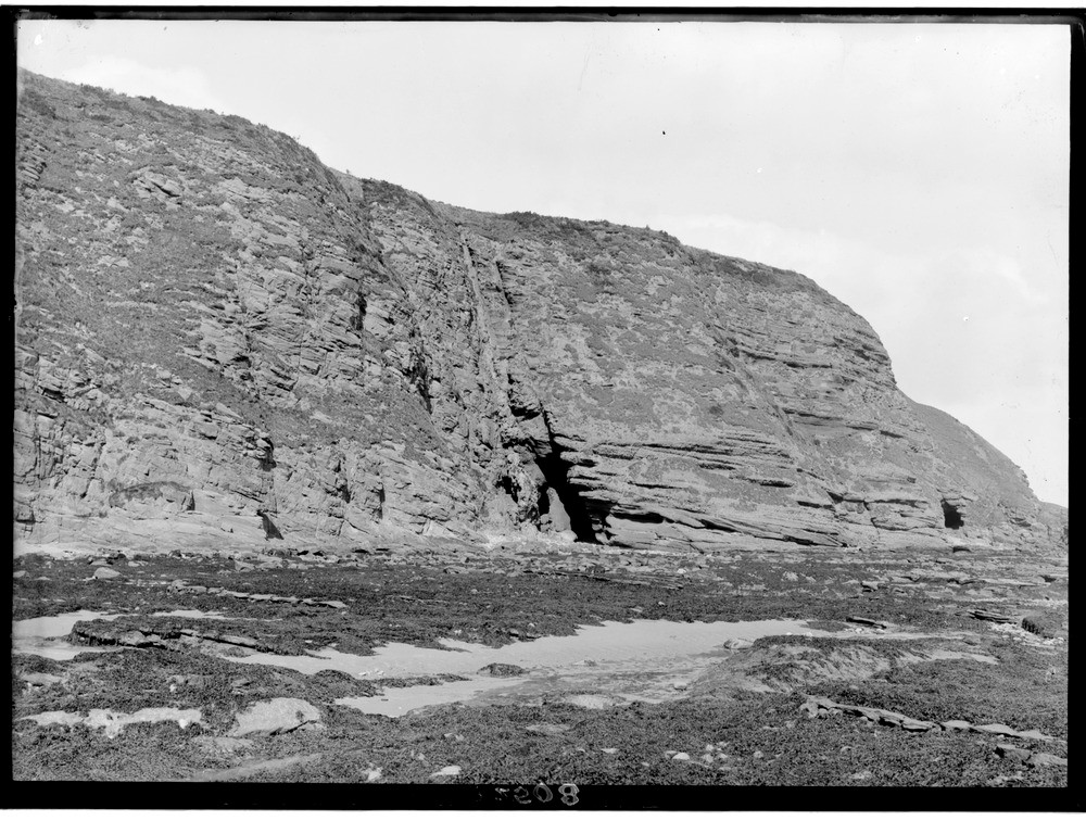
| Caption: | Northern horn of Carlingheugh Bay, 3.2 km. north-east of Arbroath, Angus. The 'Dark Cave' eroded along the line of a fault that brings the Upper Old Red Sandstone on the right against the Lower Old Red Sandstone on the left. |
| Description: | Northern horn of Carlingheugh Bay, 3.2 km. north-east of Arbroath, Angus. The 'Dark Cave' eroded along the line of a fault that brings the Upper Old Red Sandstone on the right against the Lower Old Red Sandstone on the left. A vein of barytes is seen along the main line of the fault. Further to the right, the 'Light Cave' is eroded along one of the minor faults in the Upper Old Red Sandstone. The marked difference in jointing in the two sets of rocks is very apparent. The wave-cut platform is seen in the foreground below the cliffs. |
| Date taken: | Wed Jan 01 00:00:00 GMT 1919 |
| Photographer: | Lunn, R. |
| Copyright statement: | Crown |
| Acknowledgment: | This image was digitized with grant-in-aid from SCRAN the Scottish Cultural Resources Access Network |
| X longitude/easting: | 367500 |
| Y latitude/northing: | 742500 |
| Coordinate reference system, ESPG code: | 27700 (OSGB 1936 / British National Grid) |
| Orientation: | Landscape |
| Size: | 260.96 KB; 1000 x 756 pixels; 85 x 64 mm (print at 300 DPI); 265 x 200 mm (screen at 96 DPI); |
| Average Rating: | Not yet rated |
| Categories: | Unsorted Images, Geoscience subjects/ Structural features/ Faulting |
Loading...
Loading...
Reviews
There is currently no feedback