| P number: | P002358 |
|---|---|
| Old photograph number: | C02495 |
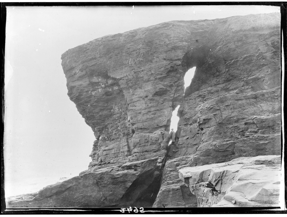
| Caption: | Shore, 2.4 km. north-east of Arbroath, Angus. Open cleft in cliff of Lower Old Red Sandstone due to branching fault forming line of weakness. |
| Description: | Shore, 2.4 km. north-east of Arbroath, Angus. Open cleft in cliff of Lower Old Red Sandstone due to branching fault forming line of weakness. As further erosion continues the arch will be breached and the mass to the left of the cleft will become an isolated sea stack similar to the one shown in C02496. Due to the combined nature of the jointing and the gently dipping strata the two stacks will be of very similar shape. |
| Date taken: | Wed Jan 01 00:00:00 GMT 1919 |
| Photographer: | Lunn, R. |
| Copyright statement: | Crown |
| Acknowledgment: | This image was digitized with grant-in-aid from SCRAN the Scottish Cultural Resources Access Network |
| X longitude/easting: | 366500 |
| Y latitude/northing: | 741500 |
| Coordinate reference system, ESPG code: | 27700 (OSGB 1936 / British National Grid) |
| Orientation: | Landscape |
| Size: | 211.58 KB; 1000 x 756 pixels; 85 x 64 mm (print at 300 DPI); 265 x 200 mm (screen at 96 DPI); |
| Average Rating: | Not yet rated |
| Categories: | Unsorted Images, Geoscience subjects/ Landforms, marine/ Influence of structure, composition, faults, joints and dip |
Loading...
Loading...
Reviews
There is currently no feedback