| P number: | P002357 |
|---|---|
| Old photograph number: | C02494 |
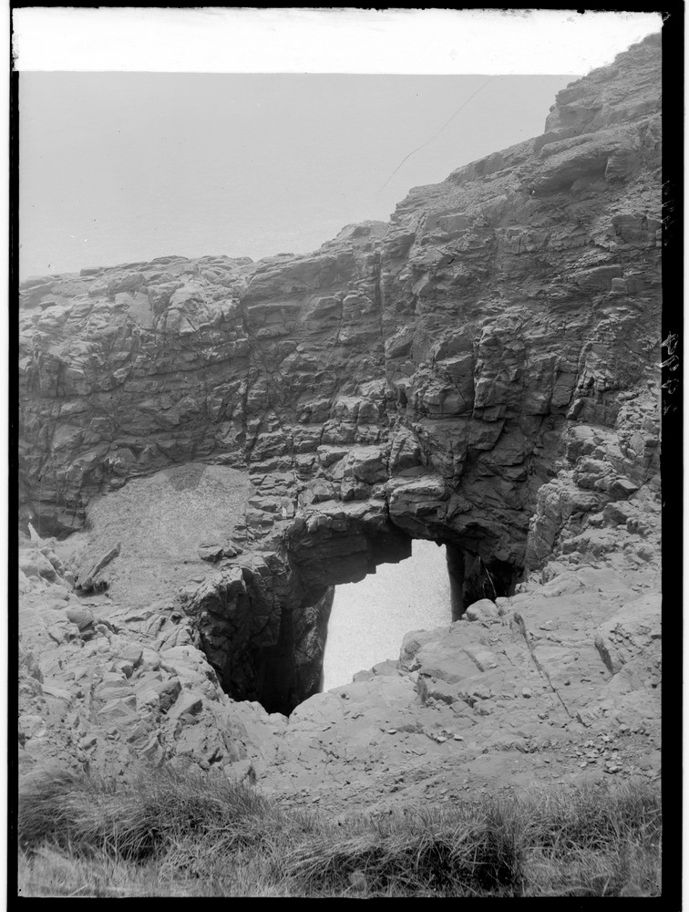
| Caption: | 1.2 km. north of Whiting Ness, 2.8 km. east-north-east of Arbroath, Angus. The formation of a 'gloup' or blowhole in Lower Old Red Sandstone (Lower Devonian) rocks. |
| Description: | 1.2 km. north of Whiting Ness, 2.8 km. east-north-east of Arbroath, Angus. The formation of a 'gloup' or blowhole in Lower Old Red Sandstone (Lower Devonian) rocks. A gloup' or blowhole cave has been driven into the Lower Old Red Sandstone along joint planes and resulting in the roof collapsing to the inland side. Although about 15 m. above sea-level, the surf during storms still rushes up the funnel, and continues to widen the hole as shown by the abrasion and rounding of the sandstone on the surface level. |
| Date taken: | Wed Jan 01 00:00:00 GMT 1919 |
| Photographer: | Lunn, R. |
| Copyright statement: | Crown |
| Acknowledgment: | This image was digitized with grant-in-aid from SCRAN the Scottish Cultural Resources Access Network |
| X longitude/easting: | 366500 |
| Y latitude/northing: | 741500 |
| Coordinate reference system, ESPG code: | 27700 (OSGB 1936 / British National Grid) |
| Orientation: | Portrait |
| Size: | 225.06 KB; 756 x 1000 pixels; 64 x 85 mm (print at 300 DPI); 200 x 265 mm (screen at 96 DPI); |
| Average Rating: | Not yet rated |
| Categories: | Unsorted Images, Geoscience subjects/ Landforms, marine/ Influence of structure, composition, faults, joints and dip |
Loading...
Loading...
Reviews
There is currently no feedback