| P number: | P002356 |
|---|---|
| Old photograph number: | C02493 |
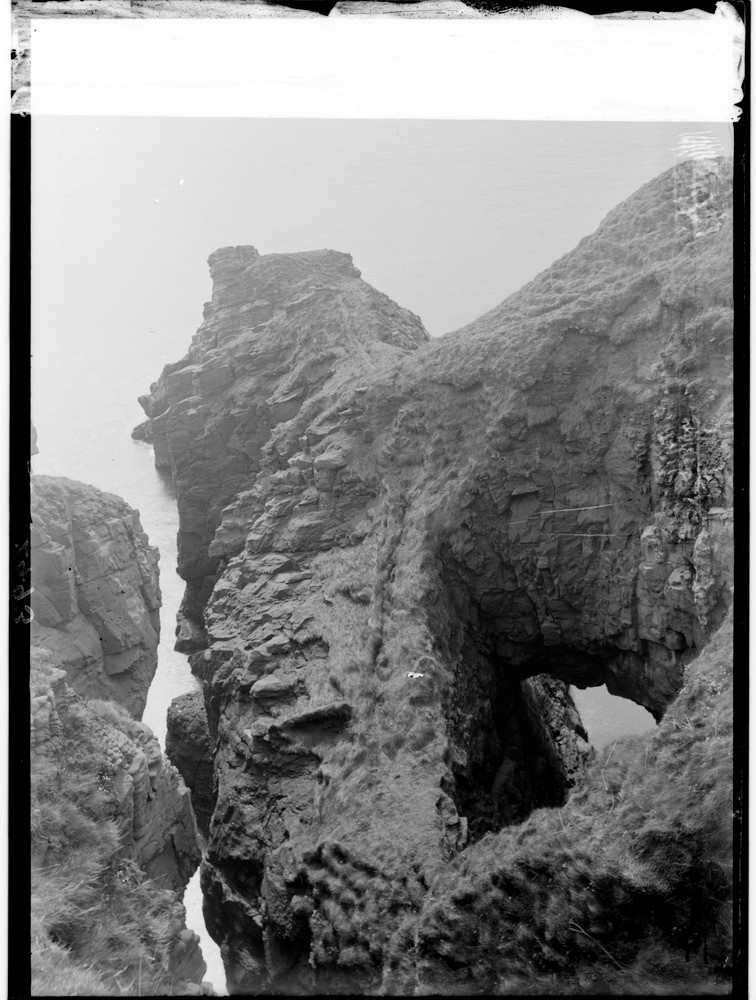
| Caption: | A little over 0.8 km. north of Whiting Ness, 1.9 km. east of Arbroath, Angus. Fallen-in sea caves in Lower Old Red Sandstone (Lower Devonian) rocks. |
| Description: | A little over 0.8 km. north of Whiting Ness, 1.9 km. east of Arbroath, Angus. Fallen-in sea caves in Lower Old Red Sandstone (Lower Devonian) rocks. The formation of a 'gloup' or blowhole (on the right) and 'geo' (on the left) by marine erosion taking advantage of the joint planes in the Lower Old Red Sandstone to erode caves. The 'gloup' cave has fallen in to landwards leaving part of the roof as a bridge, whereas in the other case, the geo, it has collapsed all the way. |
| Date taken: | Wed Jan 01 00:00:00 GMT 1919 |
| Photographer: | Lunn, R. |
| Copyright statement: | Crown |
| Acknowledgment: | This image was digitized with grant-in-aid from SCRAN the Scottish Cultural Resources Access Network |
| X longitude/easting: | 366500 |
| Y latitude/northing: | 740500 |
| Coordinate reference system, ESPG code: | 27700 (OSGB 1936 / British National Grid) |
| Orientation: | Portrait |
| Size: | 199.60 KB; 756 x 1000 pixels; 64 x 85 mm (print at 300 DPI); 200 x 265 mm (screen at 96 DPI); |
| Average Rating: | Not yet rated |
| Categories: | Unsorted Images, Geoscience subjects/ Landforms, marine/ Influence of structure, composition, faults, joints and dip, Geoscience subjects/ Landforms, marine/ Caves, blowholes, inlets |
Loading...
Loading...
Reviews
There is currently no feedback