| P number: | P002355 |
|---|---|
| Old photograph number: | C02492 |
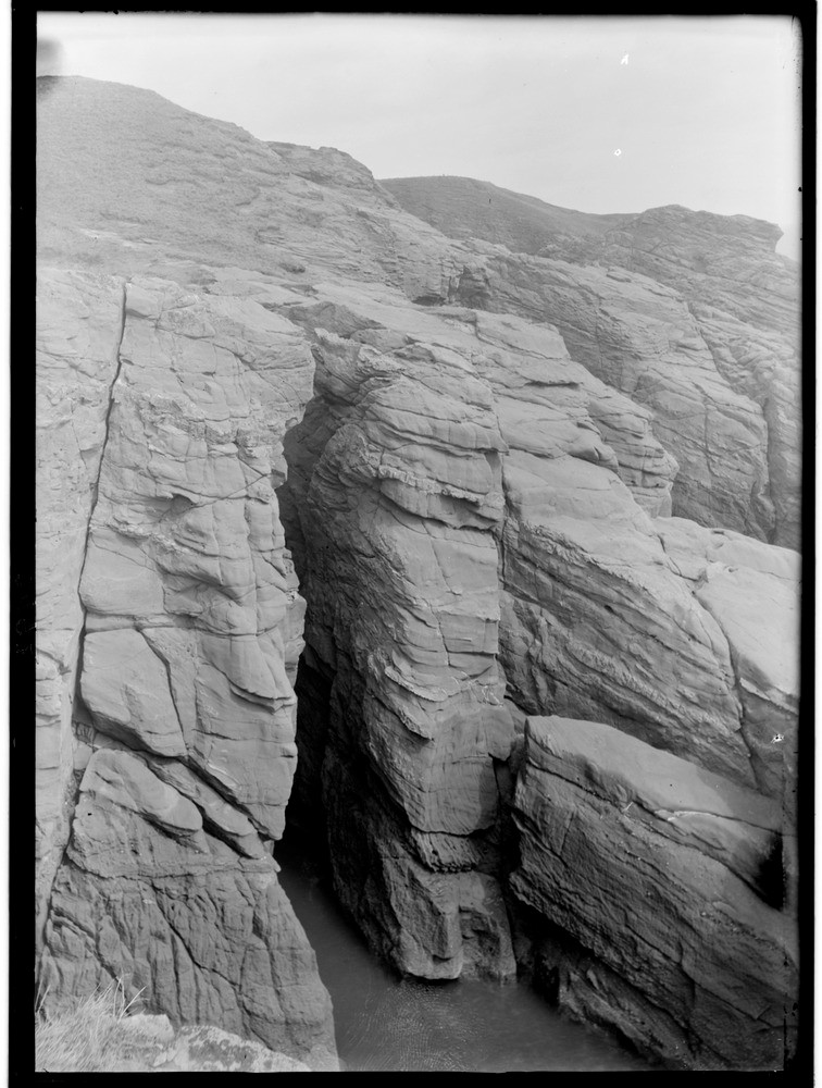
| Caption: | 0.8 km. or so north of Whiting Ness, 1.9 km. east-north-east of Arbroath, Angus. Typical coastal scenery in Lower Old Red Sandstone (Lower Devonian) rocks. |
| Description: | 0.8 km. or so north of Whiting Ness, 1.9 km. east-north-east of Arbroath, Angus. Typical coastal scenery in Lower Old Red Sandstone (Lower Devonian) rocks. A close-up view of a cliff of Lower Old Red Sandstone. Marine erosion is cutting back the coastline by taking advantage of the joint planes and eroding caves. The boulder clay at the top of the cliff is more than 15 m. above sea-level and is being removed by sea and wind erosion. |
| Date taken: | Wed Jan 01 00:00:00 GMT 1919 |
| Photographer: | Lunn, R. |
| Copyright statement: | Crown |
| Acknowledgment: | This image was digitized with grant-in-aid from SCRAN the Scottish Cultural Resources Access Network |
| X longitude/easting: | 366500 |
| Y latitude/northing: | 740500 |
| Coordinate reference system, ESPG code: | 27700 (OSGB 1936 / British National Grid) |
| Orientation: | Portrait |
| Size: | 195.46 KB; 756 x 1000 pixels; 64 x 85 mm (print at 300 DPI); 200 x 265 mm (screen at 96 DPI); |
| Average Rating: | Not yet rated |
| Categories: | Unsorted Images, Geoscience subjects/ Landforms, marine/ Caves, blowholes, inlets |
Loading...
Loading...
Reviews
There is currently no feedback