| P number: | P002354 |
|---|---|
| Old photograph number: | C02491 |
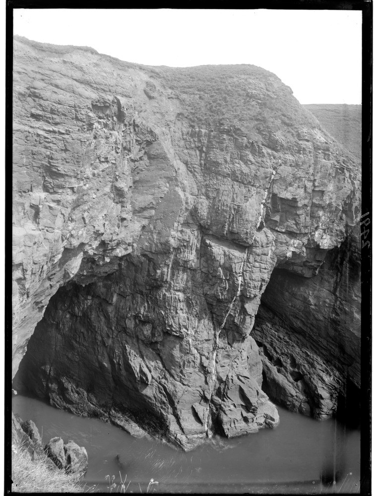
| Caption: | 0.8 km. or so north of Whiting Ness, 1.9 km. east-north-east of Arbroath, Angus. Typical coastal scenery in Lower Old Red Sandstone (Lower Devonian) rocks. |
| Description: | 0.8 km. or so north of Whiting Ness, 1.9 km. east-north-east of Arbroath, Angus. Typical coastal scenery in Lower Old Red Sandstone (Lower Devonian) rocks. Cliff of Lower Old Red Sandstone much jointed and faulted and traversed by a vein of barytes. The near cave (left) is evidently eroded along a line of a fault, the strata being much shattered and forming a line of weakness. The far cave (right) is cut along a joint plane. |
| Date taken: | Wed Jan 01 00:00:00 GMT 1919 |
| Photographer: | Lunn, R. |
| Copyright statement: | Crown |
| Acknowledgment: | This image was digitized with grant-in-aid from SCRAN the Scottish Cultural Resources Access Network |
| X longitude/easting: | 366500 |
| Y latitude/northing: | 740500 |
| Coordinate reference system, ESPG code: | 27700 (OSGB 1936 / British National Grid) |
| Orientation: | Portrait |
| Size: | 232.91 KB; 756 x 1000 pixels; 64 x 85 mm (print at 300 DPI); 200 x 265 mm (screen at 96 DPI); |
| Average Rating: | Not yet rated |
| Categories: | Unsorted Images, Geoscience subjects/ Landforms, marine/ Caves, blowholes, inlets |
Loading...
Loading...
Reviews
There is currently no feedback