| P number: | P002352 |
|---|---|
| Old photograph number: | C02488 |
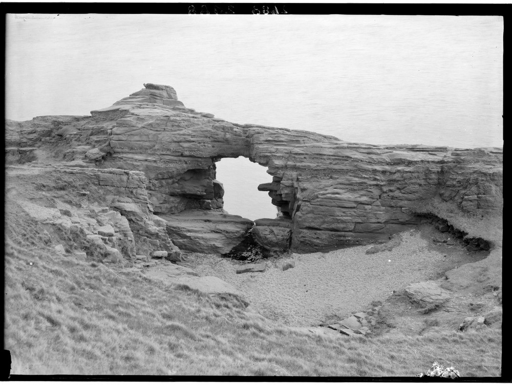
| Caption: | The 'Needle E'e', 1.9 km. east-north-east of Arbroath, Angus. A 'gloup'; a fallen-in sea cave probably on the '25 ft.' beach. The rocks are Lower Devonian sandstones. |
| Description: | The 'Needle E'e', 1.9 km. east-north-east of Arbroath, Angus. A 'gloup'; a fallen-in sea cave probably on the '25 ft.' beach. The rocks are Lower Devonian sandstones. The funnel, now above high water mark, is occasionally used by the sea during storms as shown by the shingle flooring the hollow. A 'gloup' is a Scottish term for a blowhole. |
| Date taken: | Wed Jan 01 00:00:00 GMT 1919 |
| Photographer: | Lunn, R. |
| Copyright statement: | Crown |
| Acknowledgment: | This image was digitized with grant-in-aid from SCRAN the Scottish Cultural Resources Access Network |
| X longitude/easting: | 366500 |
| Y latitude/northing: | 740500 |
| Coordinate reference system, ESPG code: | 27700 (OSGB 1936 / British National Grid) |
| Orientation: | Landscape |
| Size: | 206.31 KB; 1000 x 756 pixels; 85 x 64 mm (print at 300 DPI); 265 x 200 mm (screen at 96 DPI); |
| Average Rating: | Not yet rated |
| Categories: | Unsorted Images, Geoscience subjects/ Landforms, marine/ Caves, blowholes, inlets |
Loading...
Loading...
Reviews
There is currently no feedback