| P number: | P002348 |
|---|---|
| Old photograph number: | C02479 |
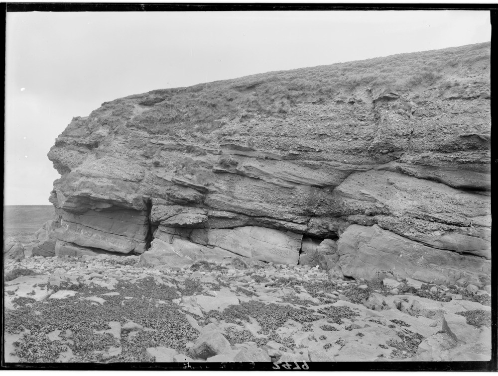
| Caption: | Whiting Ness, 1.6 km. east-north-east of Arbroath, Angus. The Unconformable junction of Upper Old Red Sandstone and the Lower Old Red Sandstone. Part of a panorama with C02480. |
| Description: | Whiting Ness, 1.6 km. east-north-east of Arbroath, Angus. The Unconformable junction of Upper Old Red Sandstone and the Lower Old Red Sandstone. Part of a panorama with C02480. Unconformable junction of red sandstones and conglomerates of the Upper Old Red Sandstone that dip very gently at 10 degrees to the south-east, resting upon an uneven surface of more inclined fine- to coarse-grained, pebbly, cross-bedded sandstones and mud-flake conglomerates of Lower Old Red Sandstone age. The line of the unconformity can be traced north-east for 250 m. It has been worked out that the ancient land surface on which the Upper Old Red Sandstone rocks have been deposited had a relief of up to 100 m. |
| Date taken: | Wed Jan 01 00:00:00 GMT 1919 |
| Photographer: | Lunn, R. |
| Copyright statement: | Crown |
| Acknowledgment: | This image was digitized with grant-in-aid from SCRAN the Scottish Cultural Resources Access Network |
| X longitude/easting: | 366500 |
| Y latitude/northing: | 741500 |
| Coordinate reference system, ESPG code: | 27700 (OSGB 1936 / British National Grid) |
| Orientation: | Landscape |
| Size: | 237.88 KB; 1000 x 756 pixels; 85 x 64 mm (print at 300 DPI); 265 x 200 mm (screen at 96 DPI); |
| Average Rating: | Not yet rated |
| Categories: | Unsorted Images, Geoscience subjects/ Stratigraphical |
Loading...
Loading...
Reviews
There is currently no feedback