| P number: | P002338 |
|---|---|
| Old photograph number: | C02406 |
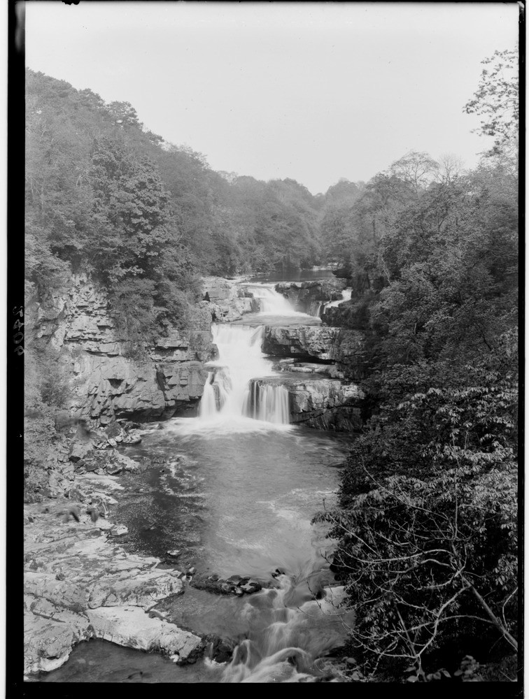
| Caption: | The River Clyde at Stonebyres Falls, 2.4 km. west of Lanark, Lanarkshire. |
| Description: | The River Clyde at Stonebyres Falls, 2.4 km. west of Lanark, Lanarkshire. Lower Devonian (formerly Lower Old Red Sandstone) sedimentary rocks of the Lanark Group dipping upstream, producing the stepped waterfalls of Stonebyres. The gorge below is being formed by the retreat of the waterfalls. Gently dipping successions of alternating hard and soft beds typically give rise to a series of stepped waterfalls of the 'Niagara' pattern, such as here. The harder beds form the top of each cascade while the intervening softer beds are continually undercut by the river. Eventually, support for whole sections of the harder beds is removed and they fall into the pool below. In this way, the whole waterfall thus gradually retreats upstream. |
| Date taken: | Wed Jan 01 00:00:00 GMT 1913 |
| Photographer: | Lunn, R. |
| Copyright statement: | Crown |
| Acknowledgment: | This image was digitized with grant-in-aid from SCRAN the Scottish Cultural Resources Access Network |
| X longitude/easting: | 285500 |
| Y latitude/northing: | 644500 |
| Coordinate reference system, ESPG code: | 27700 (OSGB 1936 / British National Grid) |
| Orientation: | Portrait |
| Size: | 230.81 KB; 756 x 1000 pixels; 64 x 85 mm (print at 300 DPI); 200 x 265 mm (screen at 96 DPI); |
| Average Rating: | Not yet rated |
| Categories: | Unsorted Images, Geoscience subjects/ Landforms, river/ Gorges and ravines |
Loading...
Loading...
Reviews
There is currently no feedback