| P number: | P002334 |
|---|---|
| Old photograph number: | C02394 |
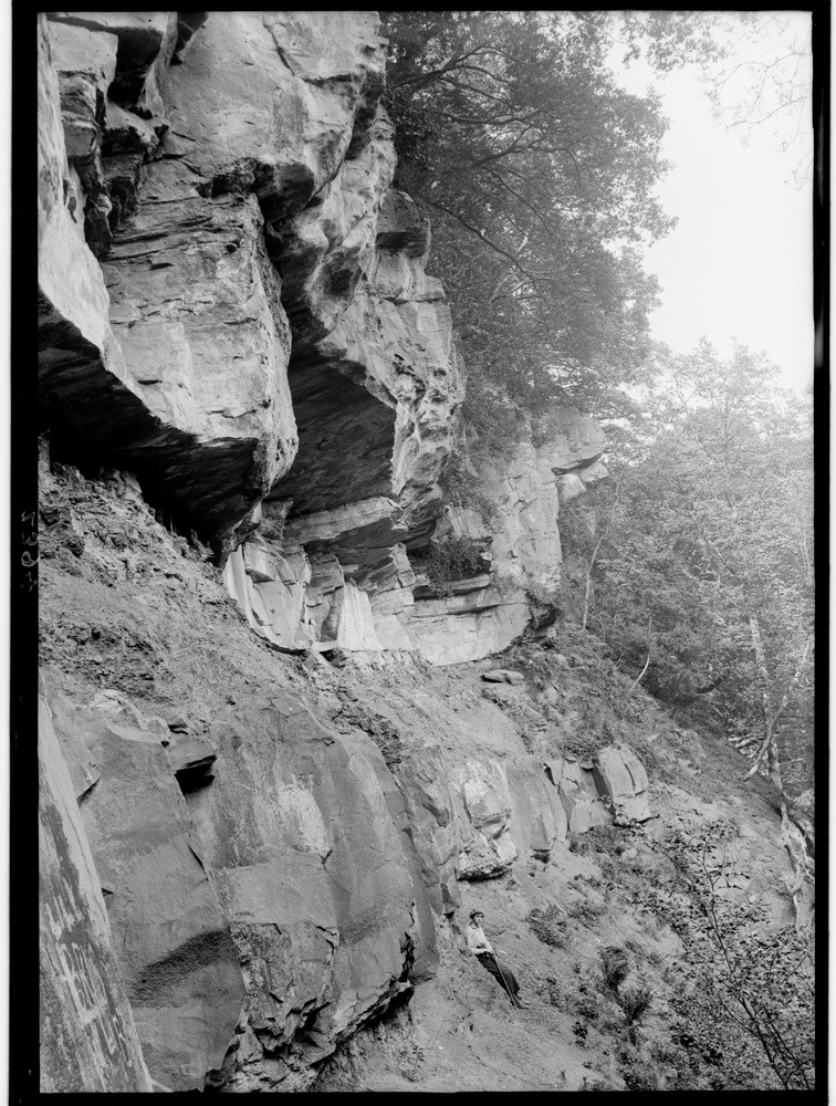
| Caption: | Dolerite sill in cliff overhanging the River Nethan a little below Craignethan Castle, 7.2 km. west-north-west of Lanark, Lanarkshire. |
| Description: | Dolerite sill in cliff overhanging the River Nethan a little below Craignethan Castle, 7.2 km. west-north-west of Lanark, Lanarkshire. Sill of quartz-dolerite intrusive into shales of the Lower Limestone Formation, Clackmannan Group (Carboniferous). Thick sandstones form the upper part of the cliff and the 'Edge Coals' have been mined at about the level of the lowest part seen in the photograph. Scotland was quite active volcanically during the early Carboniferous period, with huge volumes of basalt lava erupted in the Clyde Plateau Volcanic Formation. Numerous contemporary basic and intermediate intrusions such as dykes, sills (as here) and plugs pierce the older sedimentary rocks. |
| Date taken: | Wed Jan 01 00:00:00 GMT 1913 |
| Photographer: | Lunn, R. |
| Copyright statement: | Crown |
| Acknowledgment: | This image was digitized with grant-in-aid from SCRAN the Scottish Cultural Resources Access Network |
| X longitude/easting: | 281500 |
| Y latitude/northing: | 646500 |
| Coordinate reference system, ESPG code: | 27700 (OSGB 1936 / British National Grid) |
| Orientation: | Portrait |
| Size: | 293.92 KB; 756 x 1000 pixels; 64 x 85 mm (print at 300 DPI); 200 x 265 mm (screen at 96 DPI); |
| Average Rating: | Not yet rated |
| Categories: | Unsorted Images |
Loading...
Loading...
Reviews
There is currently no feedback