| P number: | P002326 |
|---|---|
| Old photograph number: | C02383 |
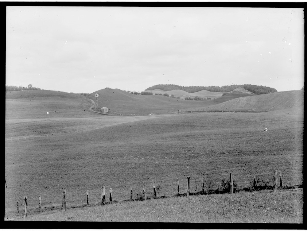
| Caption: | Kamiform mounds of sand and gravel, about 1.5 km. west-south-west of Carstairs, Lanarkshire. |
| Description: | Kamiform mounds of sand and gravel, about 1.5 km. west-south-west of Carstairs, Lanarkshire. The Carstairs district is well known for its well-developed undulating kame topography. The kamiform mounds of sand and gravel in the photograph probably formed against the successive edges of the retreating Highland ice-sheet about 10,000 years ago by streams emerging from the glacier margin. Such large deposits of sand and gravel are very valuable and many have been completely removed by commercial quarry operators. Scotland has many features which relate to the Devensian glaciation, including moraines, kames, eskers, drumlins, meltwater channels, striated pavements, varved clay deposits, etc. |
| Date taken: | Wed Jan 01 00:00:00 GMT 1913 |
| Photographer: | Lunn, R. |
| Copyright statement: | Crown |
| Acknowledgment: | This image was digitized with grant-in-aid from SCRAN the Scottish Cultural Resources Access Network |
| X longitude/easting: | 292500 |
| Y latitude/northing: | 646500 |
| Coordinate reference system, ESPG code: | 27700 (OSGB 1936 / British National Grid) |
| Orientation: | Landscape |
| Size: | 166.26 KB; 1000 x 756 pixels; 85 x 64 mm (print at 300 DPI); 265 x 200 mm (screen at 96 DPI); |
| Average Rating: | Not yet rated |
| Categories: | Unsorted Images, Geoscience subjects/ Landforms, glaciation/ Kames and eskers |
Loading...
Loading...
Reviews
There is currently no feedback