| P number: | P002324 |
|---|---|
| Old photograph number: | C02375 |
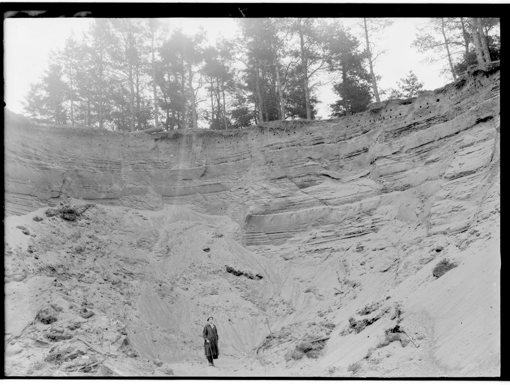
| Caption: | Sand-pit, 0.5 km. east of Carstairs, Lanarkshire. A close-up view of glacial sands and silts typical of this large deposit covering c. 2000 hectares. |
| Description: | Sand-pit, 0.5 km. east of Carstairs, Lanarkshire. A close-up view of glacial sands and silts typical of this large deposit covering c. 2000 hectares. Glacial sands and silts from the Southern Uplands deposited in a temporary lake ponded back by the Highland ice-sheet during its retreat. The small faults and folds are evidence of a subsequent disturbance in the otherwise evenly-bedded sands and silts. The sand and gravel deposits around Carstairs cover an area of about 2000 hectares, to which another 1000 hectares could possibly be added if the mosses north of Carnwath are underlain by sand and gravel. |
| Date taken: | Wed Jan 01 00:00:00 GMT 1913 |
| Photographer: | Lunn, R. |
| Copyright statement: | Crown |
| Acknowledgment: | This image was digitized with grant-in-aid from SCRAN the Scottish Cultural Resources Access Network |
| X longitude/easting: | 293500 |
| Y latitude/northing: | 646500 |
| Coordinate reference system, ESPG code: | 27700 (OSGB 1936 / British National Grid) |
| Orientation: | Landscape |
| Size: | 237.84 KB; 1000 x 756 pixels; 85 x 64 mm (print at 300 DPI); 265 x 200 mm (screen at 96 DPI); |
| Average Rating: | Not yet rated |
| Categories: | Unsorted Images, Geoscience subjects/ Landforms, glaciation/ Glacial deposits, boulder clay, sand, gravel |
Loading...
Loading...
Reviews
There is currently no feedback