| P number: | P002301 |
|---|---|
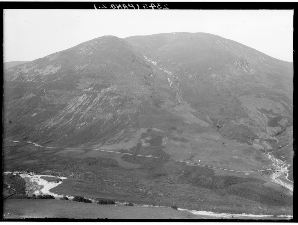
| Old photograph number: | C02345 |
| Caption: | Looking westwards across the River Roy, towards Leana Mhor, lower end of Glen Roy, Inverness-shire. The Parallel Roads of Glen Roy, left part of a panorama with C02344. |
| Description: | Looking westwards across the River Roy, towards Leana Mhor, lower end of Glen Roy, Inverness-shire. The Parallel Roads of Glen Roy, left part of a panorama with C02344. The three successive lake terraces ('roads') at levels of 260, 325 and 350 m. O.D. respectively. The shorelines were formed in a rising sequence and then a falling sequence (325 m. and 260 m.). It is thought that drainage when it occurred between levels was catastrophic, at the lower level it may have been by sub-glacial flow similar to 'glacier burst' (jokulhlaup) as seen in Iceland today. |
| Date taken: | Wed Jan 01 00:00:00 GMT 1913 |
| Photographer: | Lunn, R. |
| Copyright statement: | Crown |
| Acknowledgment: | This image was digitized with grant-in-aid from SCRAN the Scottish Cultural Resources Access Network |
| X longitude/easting: | 229500 |
| Y latitude/northing: | 785500 |
| Coordinate reference system, ESPG code: | 27700 (OSGB 1936 / British National Grid) |
| Orientation: | Landscape |
| Size: | 160.18 KB; 1000 x 756 pixels; 85 x 64 mm (print at 300 DPI); 265 x 200 mm (screen at 96 DPI); |
| Average Rating: | Not yet rated |
| Categories: | Unsorted Images, Geoscience subjects/ Landforms, glaciation/ Glacial lakes and rock basins |
Loading...
Loading...
Reviews
There is currently no feedback