| P number: | P002300 |
|---|---|
| Old photograph number: | C02344 |
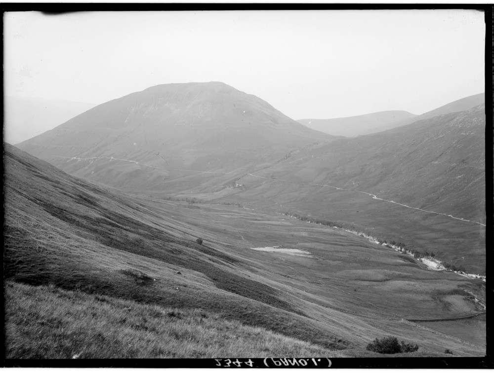
| Caption: | Looking westwards across the River Roy, towards Bohuntine Hill, lower end of Glen Roy, Inverness-shire. The Parallel Roads of Glen Roy, left part of a panorama with C02345. |
| Description: | Looking westwards across the River Roy, towards Bohuntine Hill, lower end of Glen Roy, Inverness-shire. The Parallel Roads of Glen Roy, left part of a panorama with C02345. The three successive lake terraces ('roads') at levels of 260, 325 and 350 m. O.D. respectively. The principal lakes, the shorelines of which are seen, drained across cols that controlled their levels. All are associated with the maximum or near maximum positions of Loch Lomond Readvance glaciers. Caol Lairig, the gap between the two hills, is an important site with a variety of glacial landforms. |
| Date taken: | Wed Jan 01 00:00:00 GMT 1913 |
| Photographer: | Lunn, R. |
| Copyright statement: | Crown |
| Acknowledgment: | This image was digitized with grant-in-aid from SCRAN the Scottish Cultural Resources Access Network |
| X longitude/easting: | 229500 |
| Y latitude/northing: | 785500 |
| Coordinate reference system, ESPG code: | 27700 (OSGB 1936 / British National Grid) |
| Orientation: | Landscape |
| Size: | 158.60 KB; 1000 x 756 pixels; 85 x 64 mm (print at 300 DPI); 265 x 200 mm (screen at 96 DPI); |
| Average Rating: | Not yet rated |
| Categories: | Unsorted Images, Geoscience subjects/ Landforms, glaciation/ Glacial lakes and rock basins |
Loading...
Loading...
Reviews
There is currently no feedback