| P number: | P002299 |
|---|---|
| Old photograph number: | C02343 |
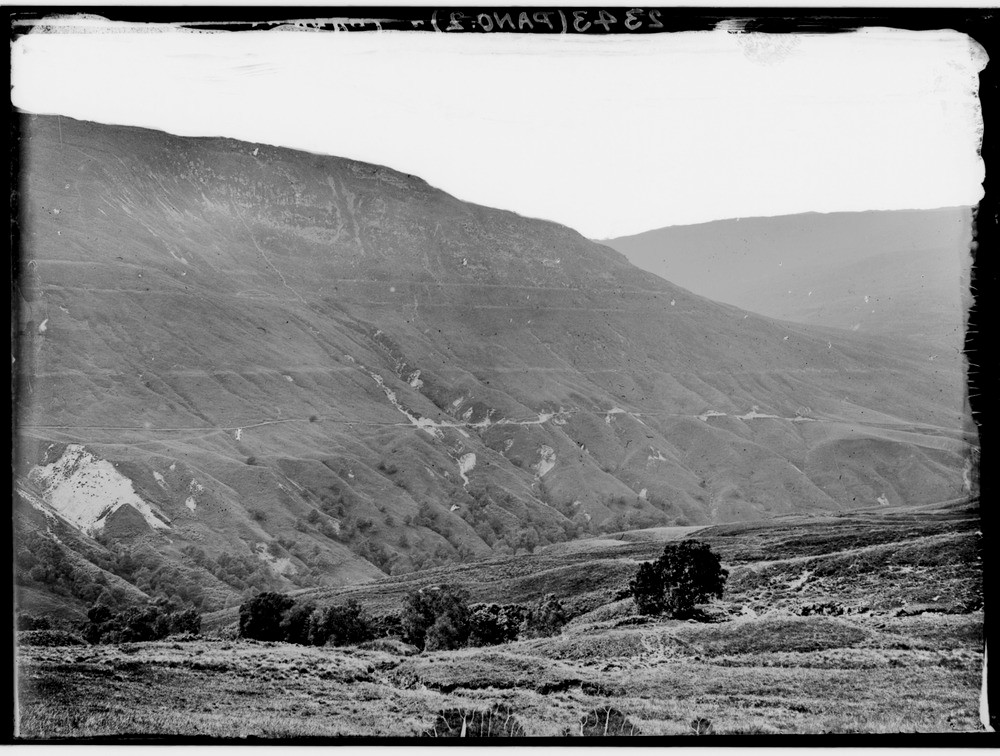
| Caption: | Bohuntine Hill seen across the River Roy, Inverness-shire. The Parallel Roads of Glen Roy, right part of a panorama with C02342. The three successive lake terraces ('roads') at levels of 260, 325 and 350 m. O.D. respectively. |
| Description: | Bohuntine Hill seen across the River Roy, Inverness-shire. The Parallel Roads of Glen Roy, right part of a panorama with C02342. The three successive lake terraces ('roads') at levels of 260, 325 and 350 m. O.D. respectively. The Parallel Roads were first documented in 1771 by Thomas Pennant and have been the subject of over 70 scientific papers. The roads also occur in adjacent parts of Glen Spean and Glen Gloy. |
| Date taken: | Wed Jan 01 00:00:00 GMT 1913 |
| Photographer: | Lunn, R. |
| Copyright statement: | Crown |
| Acknowledgment: | This image was digitized with grant-in-aid from SCRAN the Scottish Cultural Resources Access Network |
| X longitude/easting: | 229500 |
| Y latitude/northing: | 785500 |
| Coordinate reference system, ESPG code: | 27700 (OSGB 1936 / British National Grid) |
| Orientation: | Landscape |
| Size: | 217.09 KB; 1000 x 756 pixels; 85 x 64 mm (print at 300 DPI); 265 x 200 mm (screen at 96 DPI); |
| Average Rating: | Not yet rated |
| Categories: | Unsorted Images, Geoscience subjects/ Landforms, glaciation/ Glacial lakes and rock basins |
Loading...
Loading...
Reviews
There is currently no feedback