| P number: | P002298 |
|---|---|
| Old photograph number: | C02342 |
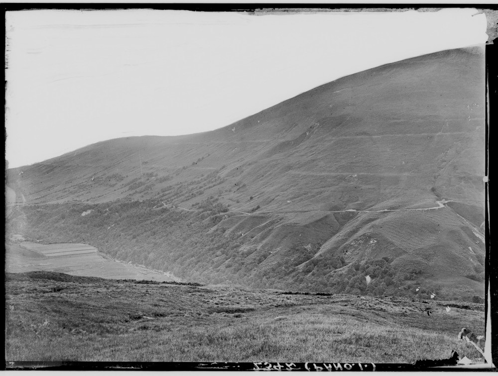
| Caption: | Bohuntine Hill seen across the River Roy, Inverness-shire. The Parallel Roads of Glen Roy, left part of a panorama with C02343. The three successive lake terraces ('roads') at levels of 260, 325 and 350 m. O.D. respectively. |
| Description: | Bohuntine Hill seen across the River Roy, Inverness-shire. The Parallel Roads of Glen Roy, left part of a panorama with C02343. The three successive lake terraces ('roads') at levels of 260, 325 and 350 m. O.D. respectively. This classic site for shorelines of an ice-dammed lake was formed during a period of glacier readvance known as the Loch Lomond Stadial. During this period ice crossing the Great Glen from the west and south dammed the lakes. The Parallel Roads form part of a much wider assemblage of glacial and fluvioglacial landforms. At Bohuntine, moraine ridges mark the ice limit of the 325 m. lake. |
| Date taken: | Wed Jan 01 00:00:00 GMT 1913 |
| Photographer: | Lunn, R. |
| Copyright statement: | Crown |
| Acknowledgment: | This image was digitized with grant-in-aid from SCRAN the Scottish Cultural Resources Access Network |
| X longitude/easting: | 229500 |
| Y latitude/northing: | 785500 |
| Coordinate reference system, ESPG code: | 27700 (OSGB 1936 / British National Grid) |
| Orientation: | Landscape |
| Size: | 188.00 KB; 1000 x 756 pixels; 85 x 64 mm (print at 300 DPI); 265 x 200 mm (screen at 96 DPI); |
| Average Rating: | Not yet rated |
| Categories: | Unsorted Images, Geoscience subjects/ Landforms, glaciation/ Glacial lakes and rock basins |
Loading...
Loading...
Reviews
There is currently no feedback