| P number: | P002269 |
|---|---|
| Old photograph number: | C02221 |
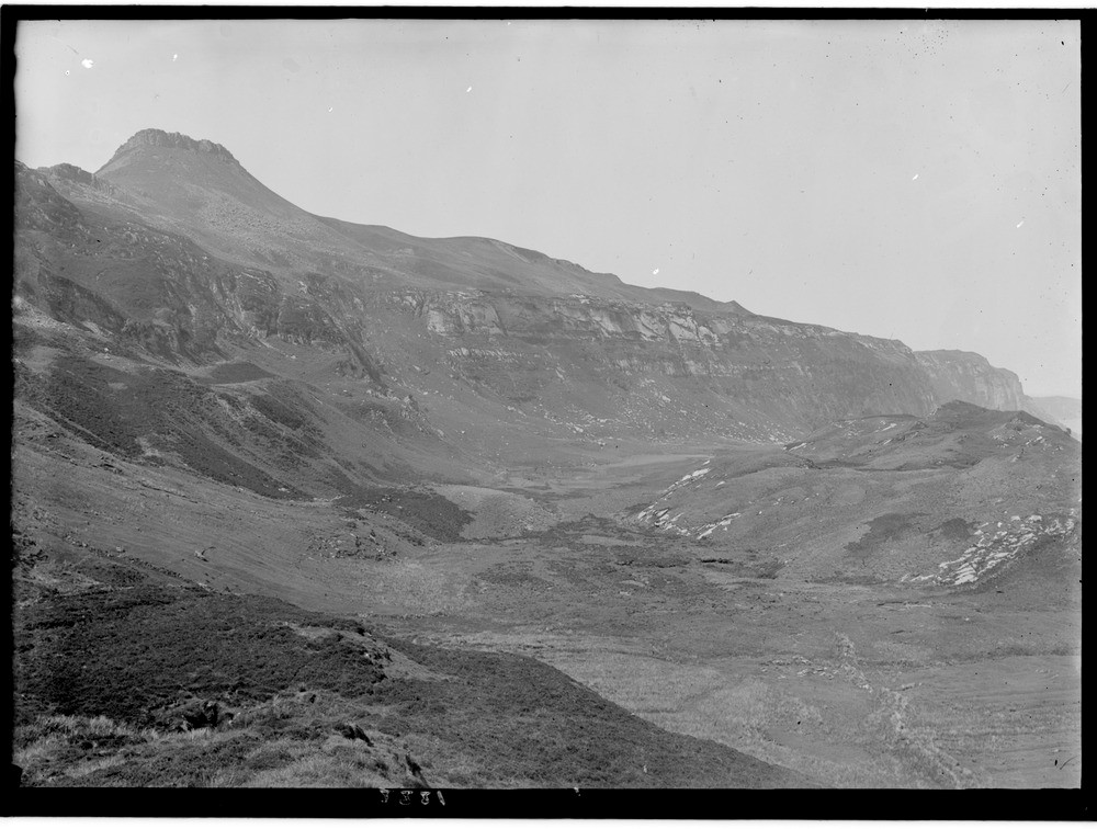
| Caption: | East side of the Island of Raasay, Inverness-shire. Landslips interfering with and partly masking the outcrops of the Jurassic succession from Lias to Great Oolite. Dun Caan, (on skyline) a capping of Tertiary plateau basalts on Great Oolite. |
| Description: | East side of the Island of Raasay, Inverness-shire. Landslips interfering with and partly masking the outcrops of the Jurassic succession from Lias to Great Oolite. Dun Caan, (on skyline) a capping of Tertiary plateau basalts on Great Oolite. The landslip involves immense masses of Middle Lias and Pabba Shales. |
| Date taken: | Mon Jan 01 00:00:00 GMT 1917 |
| Photographer: | Lunn, R. |
| Copyright statement: | Crown |
| Acknowledgment: | This image was digitized with grant-in-aid from SCRAN the Scottish Cultural Resources Access Network |
| X longitude/easting: | 158500 |
| Y latitude/northing: | 839500 |
| Coordinate reference system, ESPG code: | 27700 (OSGB 1936 / British National Grid) |
| Orientation: | Landscape |
| Size: | 183.71 KB; 1000 x 756 pixels; 85 x 64 mm (print at 300 DPI); 265 x 200 mm (screen at 96 DPI); |
| Average Rating: | Not yet rated |
| Categories: | Unsorted Images, Geoscience subjects/ Landforms, weathering/ Landslips |
Loading...
Loading...
Reviews
There is currently no feedback