| P number: | P002267 |
|---|---|
| Old photograph number: | C02215 |
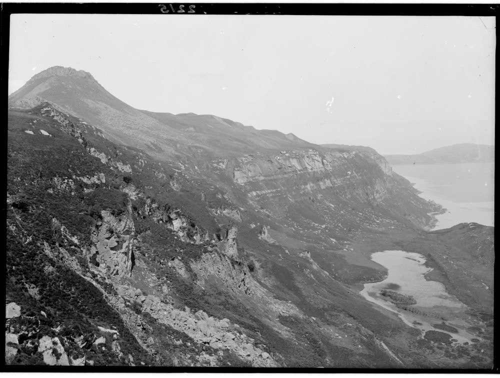
| Caption: | A general view of the Jurassic rocks below Dun Caan, east coast of Raasay, Inverness-shire. The Loch a' Chada-charnaich is seen on the right. |
| Description: | A general view of the Jurassic rocks below Dun Caan, east coast of Raasay, Inverness-shire. The Loch a' Chada-charnaich is seen on the right. Dun Caan has a capping of plateau basalt that has been variously interpreted as a sill or as lavas with a fresh hard core of columnar form. It was formed in the vast outpouring of lava in the Tertiary Volcanic Province at about 55 Ma. Below, the sequence of Jurassic rocks is as follows: the Great Estuarine Series (shales) on the gentler upper slopes with a basal oil shale at the top edge of the massive cliffs of Inferior Oolite sandstone; at the lower break in slope are the Aalenian shales of the Upper Lias while at sea level are the Middle Lias Scalpa Sandstones. On the left is a large landslip. |
| Date taken: | Mon Jan 01 00:00:00 GMT 1917 |
| Photographer: | Lunn, R. |
| Copyright statement: | Crown |
| Acknowledgment: | This image was digitized with grant-in-aid from SCRAN the Scottish Cultural Resources Access Network |
| X longitude/easting: | 158500 |
| Y latitude/northing: | 839500 |
| Coordinate reference system, ESPG code: | 27700 (OSGB 1936 / British National Grid) |
| Orientation: | Landscape |
| Size: | 195.13 KB; 1000 x 756 pixels; 85 x 64 mm (print at 300 DPI); 265 x 200 mm (screen at 96 DPI); |
| Average Rating: | Not yet rated |
| Categories: | Unsorted Images, Geoscience subjects/ Stratigraphical, Geoscience subjects/ Landforms, marine/ Cliffs |
Loading...
Loading...
Reviews
There is currently no feedback