| P number: | P002261 |
|---|---|
| Old photograph number: | C02198 |
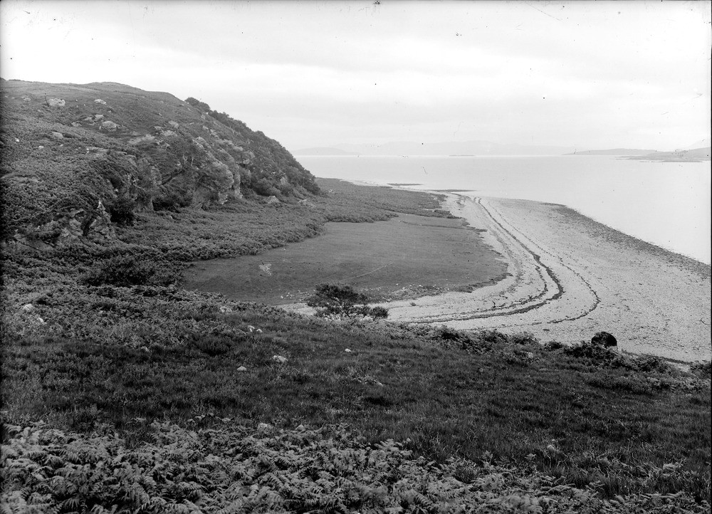
| Caption: | Eyre Point, south-east end of Island of Raasay. A 20 ft. raised beach bounded by sea cliff with caves, cut out of Triassic conglomerate (c. 220 m.y. old) overlying Torridonian sandstone (c. 810 m.y. old). |
| Description: | Eyre Point, south-east end of Island of Raasay. A 20 ft. raised beach bounded by sea cliff with caves, cut out of Triassic conglomerate (c. 220 m.y. old) overlying Torridonian sandstone (c. 810 m.y. old). Relative sea level fell after the disappearance of the glaciers, this was followed by a widespread marine transgression which culminated about 6000-6800 BP. This transgression formed the Flandrian (postglacial) raised beach and old cliff line seen in the photograph. |
| Date taken: | Mon Jan 01 00:00:00 GMT 1917 |
| Photographer: | Lunn, R. |
| Copyright statement: | Crown |
| Acknowledgment: | This image was digitized with grant-in-aid from SCRAN the Scottish Cultural Resources Access Network |
| X longitude/easting: | 158500 |
| Y latitude/northing: | 834500 |
| Coordinate reference system, ESPG code: | 27700 (OSGB 1936 / British National Grid) |
| Orientation: | Landscape |
| Size: | 256.29 KB; 1000 x 722 pixels; 85 x 61 mm (print at 300 DPI); 265 x 191 mm (screen at 96 DPI); |
| Average Rating: | Not yet rated |
| Categories: | Unsorted Images, Geoscience subjects/ Landforms, marine/ Raised beaches |
Loading...
Loading...
Reviews
There is currently no feedback