| P number: | P002240 |
|---|---|
| Old photograph number: | C02038 |
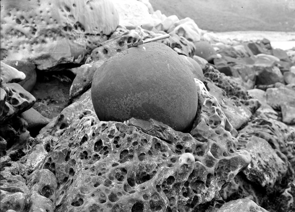
| Caption: | Shore, 0.4 km. east of Cove Harbour, 1.3 km. north-east of Cockburnspath, Berwickshire. Concretion. |
| Description: | Shore, 0.4 km. east of Cove Harbour, 1.3 km. north-east of Cockburnspath, Berwickshire. Concretion. Concretionary balls with calcareous cement in a sandstone of Ballagan Formation, Inverclyde Group (formerly Calciferous Sandstone Measures). This is an exceptionally large concretion which forms when minerals (here calcite but can also be silica) migrate towards a centre and concentrate into a discrete spherical body. Carboniferous strata in the Cockburnspath to Dunbar area rest on Silurian rocks of the Southern Uplands terrane and form the landward margin of a large basin which extends eastwards into the North Sea. When rocks are deformed, the concretions also deform, commonly into ellipsoids. By making an assumption about their original shape, the proportions of the deformed concretions can be used as a measure of the amount of deformation. |
| Date taken: | Thu Jan 01 00:00:00 GMT 1914 |
| Photographer: | Lunn, R. |
| Copyright statement: | Crown |
| Acknowledgment: | This image was digitized with grant-in-aid from SCRAN the Scottish Cultural Resources Access Network |
| X longitude/easting: | 378500 |
| Y latitude/northing: | 671500 |
| Coordinate reference system, ESPG code: | 27700 (OSGB 1936 / British National Grid) |
| Orientation: | Landscape |
| Size: | 243.25 KB; 1000 x 721 pixels; 85 x 61 mm (print at 300 DPI); 265 x 191 mm (screen at 96 DPI); |
| Average Rating: | Not yet rated |
| Categories: | Best of BGS Images/ Images from the archives, Geoscience subjects/ Sedimentary features/ Concretions and nodules |
Loading...
Loading...
Reviews
There is currently no feedback