| P number: | P002239 |
|---|---|
| Old photograph number: | C02036 |
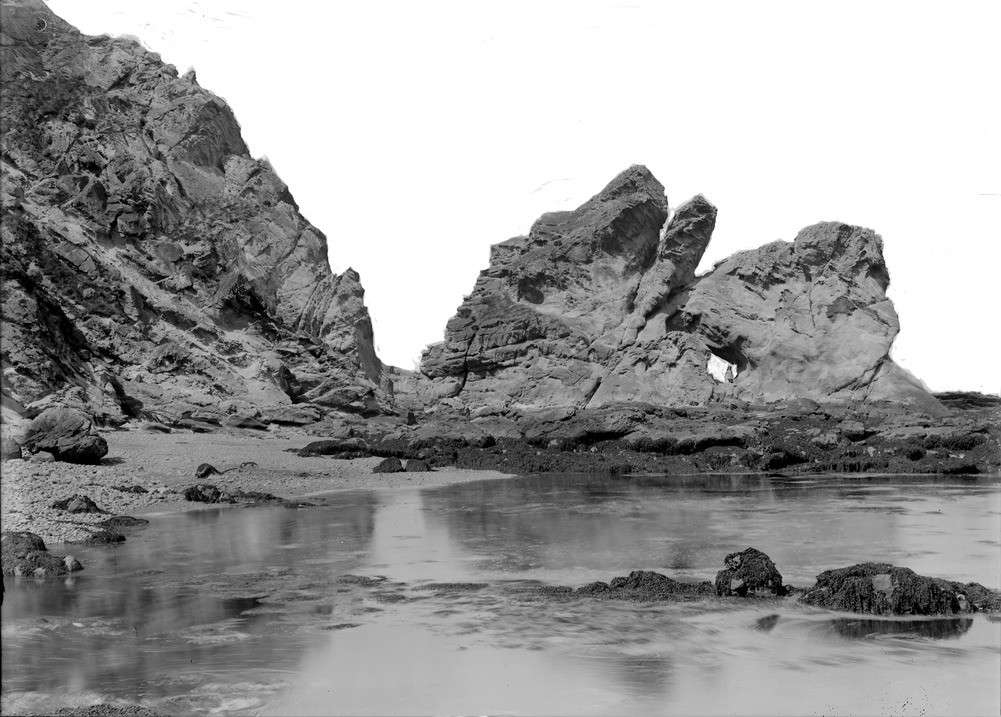
| Caption: | South side of Cove Harbour, 1.1 km. north-east of Cockburnspath, Berwickshire. Sea stack in Carboniferous sandstones. |
| Description: | South side of Cove Harbour, 1.1 km. north-east of Cockburnspath, Berwickshire. Sea stack in Carboniferous sandstones. Sandstones of Strathclyde Group (formerly Calciferous Sandstone Measures) dipping steeply northwards near a fault. The sandstones are sufficiently hard to have formed a sea stack, here punctured by wave action to form a natural tunnel or arch. Carboniferous strata in the Cockburnspath to Dunbar area rest on Silurian rocks of the Southern Uplands terrane and form the landward margin of a large basin which extends eastwards into the North Sea. |
| Date taken: | Thu Jan 01 00:00:00 GMT 1914 |
| Photographer: | Lunn, R. |
| Copyright statement: | Crown |
| Acknowledgment: | This image was digitized with grant-in-aid from SCRAN the Scottish Cultural Resources Access Network |
| X longitude/easting: | 378500 |
| Y latitude/northing: | 671500 |
| Coordinate reference system, ESPG code: | 27700 (OSGB 1936 / British National Grid) |
| Orientation: | Landscape |
| Size: | 198.12 KB; 1001 x 717 pixels; 85 x 61 mm (print at 300 DPI); 265 x 190 mm (screen at 96 DPI); |
| Average Rating: | Not yet rated |
| Categories: | Unsorted Images, Geoscience subjects/ Stratigraphical |
Loading...
Loading...
Reviews
There is currently no feedback