| P number: | P002236 |
|---|---|
| Old photograph number: | C02030 |
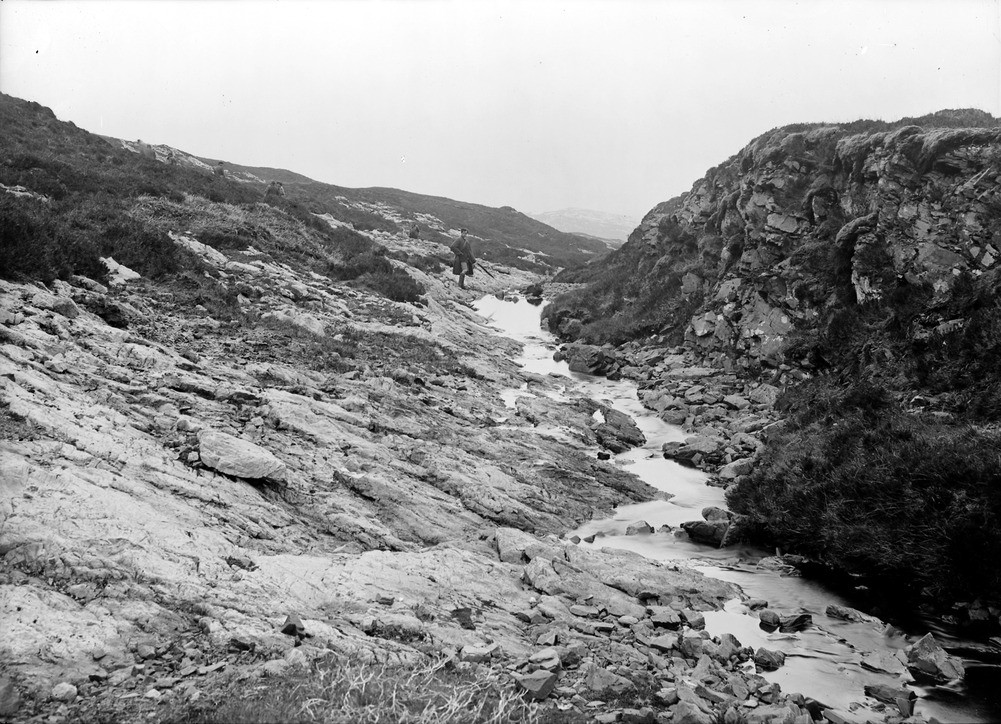
| Caption: | Burn at Druim Poll Eoghainn, 1 m. south-south-west of Knockan, 13.7 km. south-south-west of Inchnadamph, looking east, Sutherland. The outcrop of the Moine Thrust plane. |
| Description: | Burn at Druim Poll Eoghainn, 1 m. south-south-west of Knockan, 13.7 km. south-south-west of Inchnadamph, looking east, Sutherland. The outcrop of the Moine Thrust plane. The bared sole of the thrust plane lies over successive schuppen of Cambrian dolomitic limestones of the Eilean Dubh Group. Cliffs of flaggy Moine schists are seen on the right. The Moine Thrust is the highest thrust in the Moine Thrust Zone, a zone of thrusting associated with folding and low-grade metamorphism that stretches from Loch Eriboll to the north coast of Skye and probably to the Sound of Iona. Schuppen or imbricate structure is a tectonic structure displayed by a series of nearly parallel and overlapping high-angle reverse faults or thrusts. It forms a series of similar wedges that have the same displacement and are all inclined in the same direction. |
| Date taken: | Thu Jan 01 00:00:00 GMT 1914 |
| Photographer: | Lunn, R. |
| Copyright statement: | Crown |
| Acknowledgment: | This image was digitized with grant-in-aid from SCRAN the Scottish Cultural Resources Access Network |
| X longitude/easting: | 220500 |
| Y latitude/northing: | 909500 |
| Coordinate reference system, ESPG code: | 27700 (OSGB 1936 / British National Grid) |
| Orientation: | Landscape |
| Size: | 274.09 KB; 1001 x 724 pixels; 85 x 61 mm (print at 300 DPI); 265 x 192 mm (screen at 96 DPI); |
| Average Rating: | Not yet rated |
| Categories: | Unsorted Images, Geoscience subjects/ Structural features/ Thrusting |
Loading...
Loading...
Reviews
There is currently no feedback