| P number: | P002235 |
|---|---|
| Old photograph number: | C02029 |
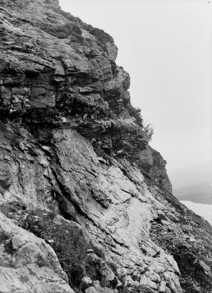
| Caption: | Knockan Cliff, 13.7 km. south-south-west of Inchnadamph, looking south, Sutherland. The outcrop of Moine Thrust plane. |
| Description: | Knockan Cliff, 13.7 km. south-south-west of Inchnadamph, looking south, Sutherland. The outcrop of Moine Thrust plane. The sequence from top to bottom is: platy and crushed Moine schist; a wedge of Lewisian gneiss; the thrust plane; white crystalline marble (Cambrian). The Moine Thrust Zone is a zone of thrusting associated with folding and low-grade metamorphism. It forms a narrow but continuous belt stretching south-west from Loch Eriboll on the north coast to Skye. Within the zone there are several major thrusts, the Moine Thrust is the highest and formed the earliest. |
| Date taken: | Thu Jan 01 00:00:00 GMT 1914 |
| Photographer: | Lunn, R. |
| Copyright statement: | Crown |
| Acknowledgment: | This image was digitized with grant-in-aid from SCRAN the Scottish Cultural Resources Access Network |
| X longitude/easting: | 219500 |
| Y latitude/northing: | 909500 |
| Coordinate reference system, ESPG code: | 27700 (OSGB 1936 / British National Grid) |
| Orientation: | Portrait |
| Size: | 259.49 KB; 724 x 1000 pixels; 61 x 85 mm (print at 300 DPI); 192 x 265 mm (screen at 96 DPI); |
| Average Rating: | Not yet rated |
| Categories: | Unsorted Images, Geoscience subjects/ Structural features/ Thrusting |
Loading...
Loading...
Reviews
There is currently no feedback