| P number: | P002194 |
|---|---|
| Old photograph number: | C01950 |
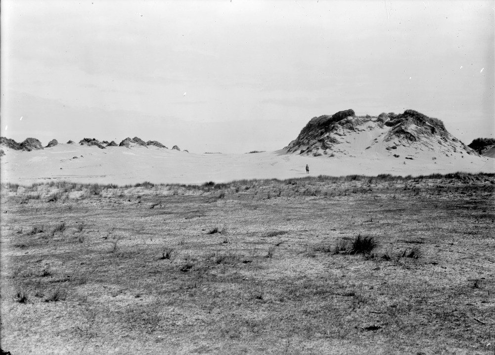
| Caption: | Morrich More, 4.9 km. north-east of Tain, Ross & Cromarty. Sand advancing through wind-eroded temporarily fixed dunes. Foreground shows vegetation of area from which sand has recently been swept. |
| Description: | Morrich More, 4.9 km. north-east of Tain, Ross & Cromarty. Sand advancing through wind-eroded temporarily fixed dunes. Foreground shows vegetation of area from which sand has recently been swept. The Morrich is a low-lying area of postglacial and recent sand ridges which are moving north-eastwards towards the sea from a well-marked postglacial cliff line. The growth seaward of the strand plain has been continuous for 7000 years since the Flandrian transgression. |
| Date taken: | Wed Jan 01 00:00:00 GMT 1913 |
| Photographer: | Lunn, R. |
| Copyright statement: | Crown |
| Acknowledgment: | This image was digitized with grant-in-aid from SCRAN the Scottish Cultural Resources Access Network |
| X longitude/easting: | 283500 |
| Y latitude/northing: | 885500 |
| Coordinate reference system, ESPG code: | 27700 (OSGB 1936 / British National Grid) |
| Orientation: | Landscape |
| Size: | 213.31 KB; 1001 x 718 pixels; 85 x 61 mm (print at 300 DPI); 265 x 190 mm (screen at 96 DPI); |
| Average Rating: | Not yet rated |
| Categories: | Unsorted Images, Geoscience subjects/ Landforms, wind/ Sand-dunes |
Loading...
Loading...
Reviews
There is currently no feedback