| P number: | P002109 |
|---|---|
| Old photograph number: | C01338 |
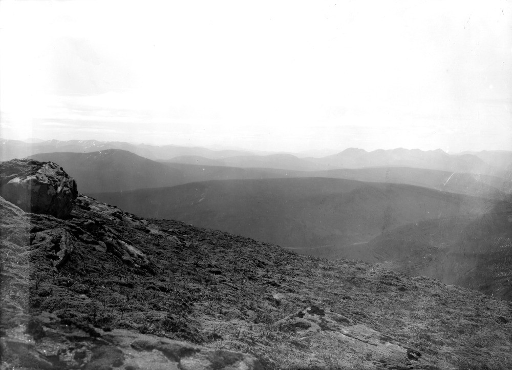
| Caption: | View from the summit of Sgurr nan Clach Geala, Fannich Forest, looking west-north-west, Ross & Cromarty. |
| Description: | In the foreground are mountains of crystalline schists of the Moine series. The distant mountains (from Achnashellach on left to An Teallach on right) consist of Cambrian, Torridonian and Lewisian rocks, some of which have been affected by Post-Cambrian Caledonian orogenic movements. The model of a single elevated surface has now given way to a model where there a series of groupings of features at various levels is recognized - this indicates the existence of intermediate erosion surfaces. Debate continues as to whether the surfaces are the result of subaerial erosion during periods of stillstand during upwarping of the planar surface or of marine planation. It is generally accepted that the surfaces were formed after the cessation of the volcanic activity of the Tertiary igneous period. The general uniformity of the levels of the summits gives the impression of a flat elevated plateau-like surface that has been deeply dissected. Part of a panorama with C01339, C01340. The description is for the whole panorama. |
| Date taken: | Sat Jan 01 00:00:00 GMT 1910 |
| Photographer: | Lunn, R. |
| Copyright statement: | Crown |
| Acknowledgment: | This image was digitized with grant-in-aid from SCRAN the Scottish Cultural Resources Access Network |
| X longitude/easting: | 218500 |
| Y latitude/northing: | 871500 |
| Coordinate reference system, ESPG code: | 27700 (OSGB 1936 / British National Grid) |
| Orientation: | Landscape |
| Size: | 150.29 KB; 1000 x 722 pixels; 85 x 61 mm (print at 300 DPI); 265 x 191 mm (screen at 96 DPI); |
| Average Rating: | Not yet rated |
| Categories: | Unsorted Images, Geoscience subjects/ Landforms, weathering/ Plateaux, Geoscience subjects/ General views/ Metamorphic rock country |
Loading...
Loading...
Reviews
There is currently no feedback