| P number: | P002102 |
|---|---|
| Old photograph number: | C01319 |
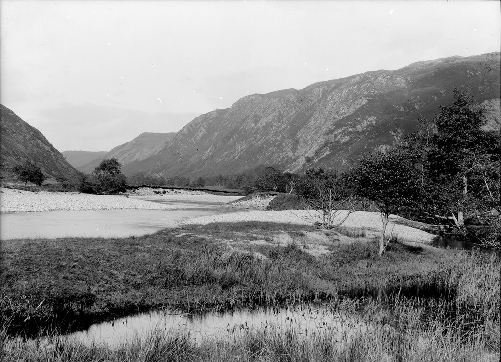
| Caption: | Looking north-north-east from near Inverchoran, Strath Conon, Inverness-shire. The River Meig valley developed along the shatter belt of the major Strathconon Fault. |
| Description: | Looking north-north-east from near Inverchoran, Strath Conon, Inverness-shire. The River Meig valley developed along the shatter belt of the major Strathconon Fault. The fault has formed a line of weakness from Loch Hourn to the Kildermorie Forest in Easter Ross. This enabled preferential erosion during the last glaciation to form the U-shaped valley and now erosion by the river. Note the shingle banks and the cut-off channel in the foreground. |
| Date taken: | Sat Jan 01 00:00:00 GMT 1910 |
| Photographer: | Lunn, R. |
| Copyright statement: | Crown |
| Acknowledgment: | This image was digitized with grant-in-aid from SCRAN the Scottish Cultural Resources Access Network |
| X longitude/easting: | 226500 |
| Y latitude/northing: | 850500 |
| Coordinate reference system, ESPG code: | 27700 (OSGB 1936 / British National Grid) |
| Orientation: | Landscape |
| Size: | 259.32 KB; 1001 x 725 pixels; 85 x 61 mm (print at 300 DPI); 265 x 192 mm (screen at 96 DPI); |
| Average Rating: | Not yet rated |
| Categories: | Unsorted Images, Geoscience subjects/ Landforms, river/ Valleys, Geoscience subjects/ Landforms, river/ Valleys controlled by faults and shatter belts |
Loading...
Loading...
Reviews
There is currently no feedback