| P number: | P002081 |
|---|---|
| Old photograph number: | C01256 |
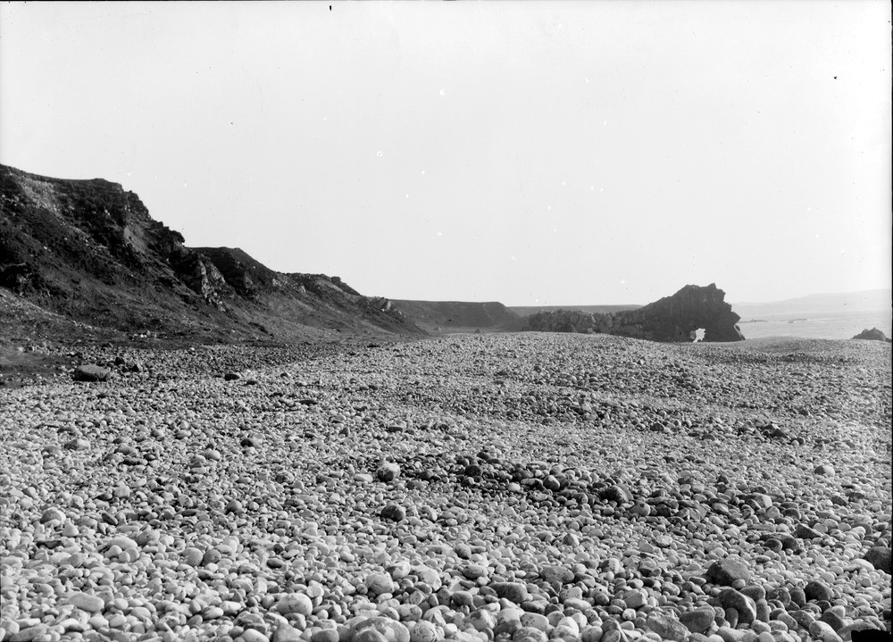
| Caption: | North of Brein Phort, south of Loch Tarbert, west coast of Jura, Argyllshire. Raised beach. |
| Description: | North of Brein Phort, south of Loch Tarbert, west coast of Jura, Argyllshire. Raised beach. Extensive bank of coarse shingle on the 7.6 m. (25 ft.) raised beach. The back feature cliff behind (on left) is cut in shingle of the 30.5 m. (100 ft.) raised beach. Note basalt dyke in right background forming an old sea stack pierced to form a natural arch. Raised beaches are common features along the coast of Scotland and were formed when the sea level was higher than at present. This typically occurs when an ice-cap retreats, rapidly releasing large quantities of water which raises the sea level. However, through time, the land rises isostatically with the removal of the ice load, and the sea level appears to fall again relative to the land. |
| Date taken: | Fri Jan 01 00:00:00 GMT 1904 |
| Photographer: | Lunn, R. |
| Copyright statement: | Crown |
| Acknowledgment: | This image was digitized with grant-in-aid from SCRAN the Scottish Cultural Resources Access Network |
| X longitude/easting: | 146500 |
| Y latitude/northing: | 677500 |
| Coordinate reference system, ESPG code: | 27700 (OSGB 1936 / British National Grid) |
| Orientation: | Landscape |
| Size: | 244.31 KB; 1000 x 719 pixels; 85 x 61 mm (print at 300 DPI); 265 x 190 mm (screen at 96 DPI); |
| Average Rating: | Not yet rated |
| Categories: | Unsorted Images, Geoscience subjects/ Landforms, marine/ Raised beaches |
Loading...
Loading...
Reviews
There is currently no feedback