| P number: | P225576 |
|---|---|
| Old photograph number: | NI00902 |
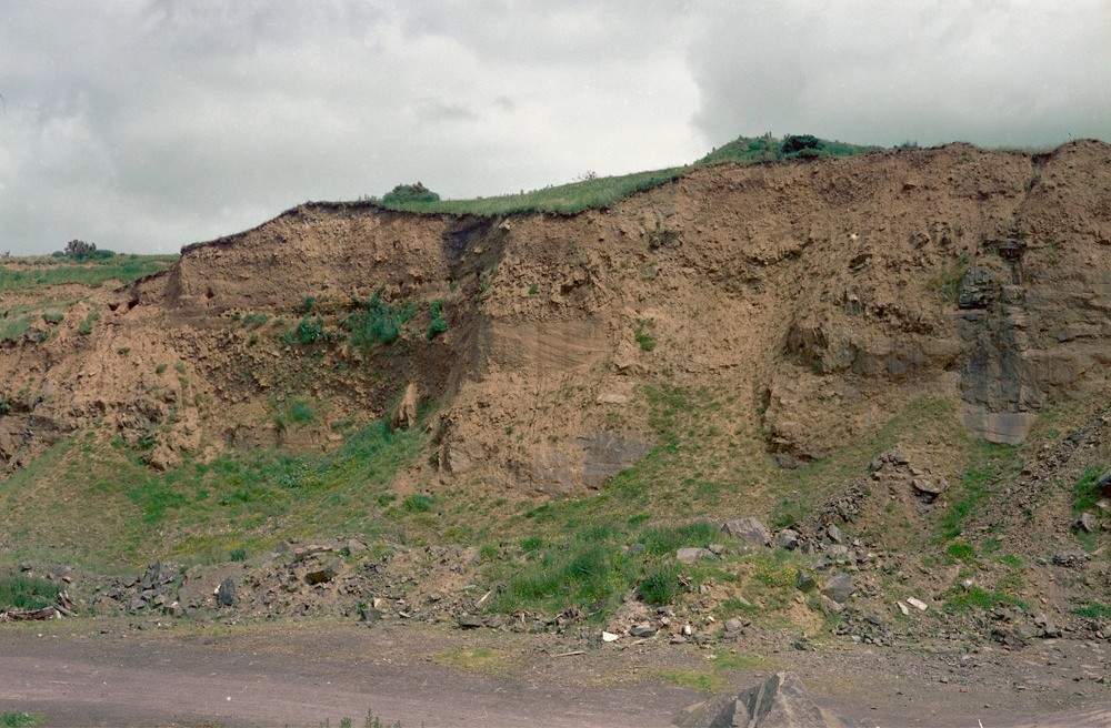
| Caption: | Tandragee Main Quarry, SE face of upper level, 1.27 km. SE of Tandragee Castle. |
| Description: | Tandragee Main Quarry, SE face of upper level, 1.27 km. SE of Tandragee Castle. Two boulder clay horizons separated by sands and gravels. Cross-bedded sands and gravels separating two boulder clay horizons, overlying Lower Palaeozoic greywackes. |
| Date taken: | Thu Jan 01 00:00:00 GMT 1981 |
| Photographer: | Jeffery, C.J. |
| Copyright statement: | NERC |
| X longitude/easting: | 304140 |
| Y latitude/northing: | 345620 |
| Coordinate reference system, ESPG code: | 2157 (IRENET95 / Irish Transverse Mercator) |
| Orientation: | Landscape |
| Size: | 487.38 KB; 1000 x 656 pixels; 85 x 56 mm (print at 300 DPI); 265 x 174 mm (screen at 96 DPI); |
| Average Rating: | Not yet rated |
| Categories: | Special collections/ Northern Ireland/ Armagh |
Loading...
Loading...
Reviews
There is currently no feedback