| P number: | P002064 |
|---|---|
| Old photograph number: | C01169 |
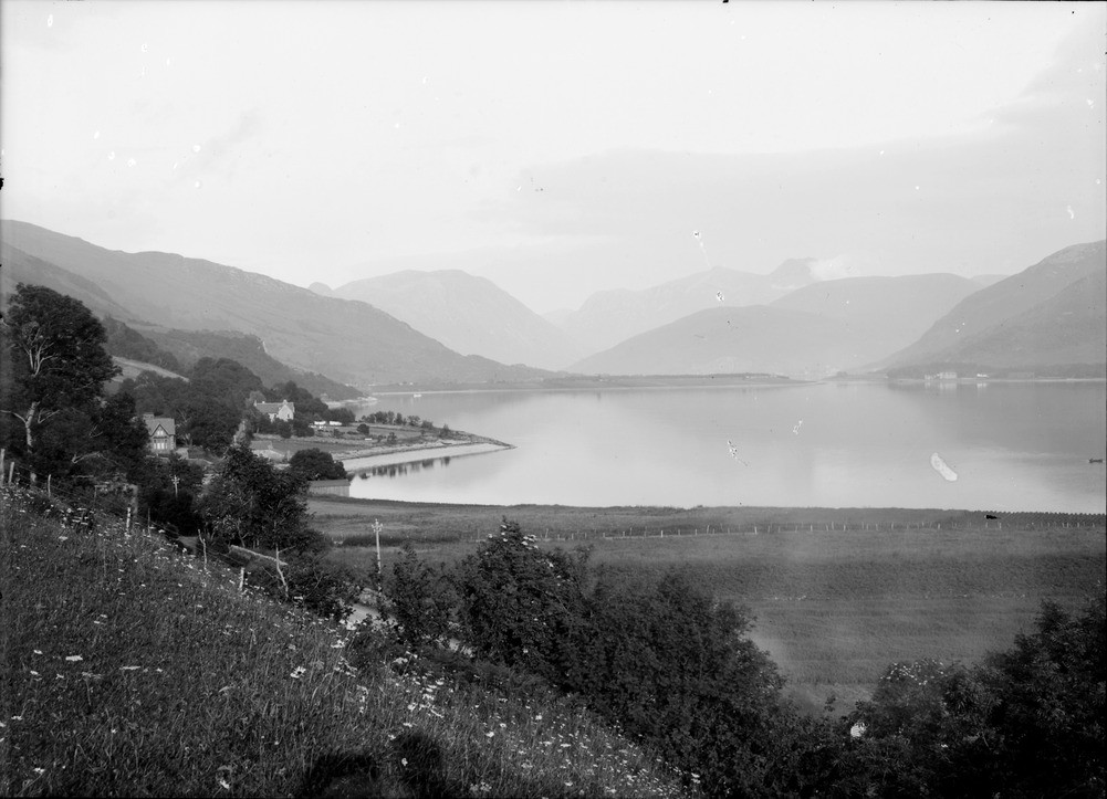
| Caption: | View from Onich, Loch Linnhe, looking south towards Beinn a' Bheithir, Inverness-shire. Gravel platform of the Flandrian '25 ft.' raised beach fringing the loch. The Glencoe hills can be seen in the background. |
| Description: | View from Onich, Loch Linnhe, looking south towards Beinn a' Bheithir, Inverness-shire. Gravel platform of the Flandrian '25 ft.' raised beach fringing the loch. The Glencoe hills can be seen in the background. The raised beach can be seen in the centre, fringing the loch and on the wide platform at Ballachulish in the distance. The Glencoe hills form a major Caledonian Orogeny igneous intrusive complex called a cauldron subsidence. |
| Date taken: | Fri Jan 01 00:00:00 GMT 1904 |
| Photographer: | Lunn, R. |
| Copyright statement: | Crown |
| Acknowledgment: | This image was digitized with grant-in-aid from SCRAN the Scottish Cultural Resources Access Network |
| X longitude/easting: | 202500 |
| Y latitude/northing: | 761500 |
| Coordinate reference system, ESPG code: | 27700 (OSGB 1936 / British National Grid) |
| Orientation: | Landscape |
| Size: | 156.42 KB; 1001 x 723 pixels; 85 x 61 mm (print at 300 DPI); 265 x 191 mm (screen at 96 DPI); |
| Average Rating: | Not yet rated |
| Categories: | Unsorted Images, Geoscience subjects/ Landforms, marine/ Raised beaches |
Loading...
Loading...
Reviews
There is currently no feedback