| P number: | P225417 |
|---|---|
| Old photograph number: | NI00742 |
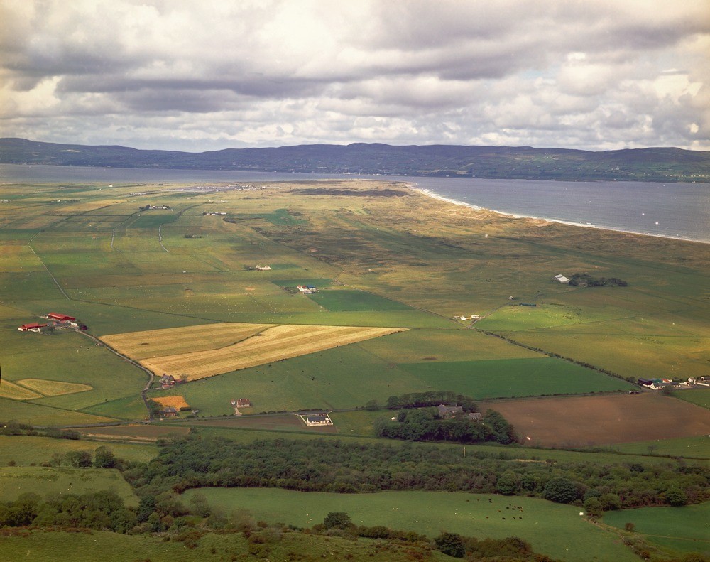
| Caption: | Magilligan. Looking W. |
| Description: | Magilligan. Looking W. Blown-sand and shingle ridges of Magilligan promontory. Dunes of blown sand are visible along the shoreline; inland the drainage channels follow the commonly peat-filled hollows between the old sand bars or shingle-ridges that make up the flatlands. View from Bishop's Road. |
| Date taken: | Wed Jan 01 00:00:00 GMT 1975 |
| Photographer: | Pulsford, J.M. |
| Copyright statement: | NERC |
| X longitude/easting: | 268000 |
| Y latitude/northing: | 437000 |
| Coordinate reference system, ESPG code: | 2157 (IRENET95 / Irish Transverse Mercator) |
| Orientation: | Landscape |
| Size: | 435.46 KB; 1000 x 791 pixels; 85 x 67 mm (print at 300 DPI); 265 x 209 mm (screen at 96 DPI); |
| Average Rating: | Not yet rated |
| Categories: | Special collections/ Northern Ireland/ Londonderry, Geoscience subjects/ Landforms, marine/ Coastal deposition, sand-bars, shingle-ridges, storm-beaches |
Loading...
Loading...
Reviews
There is currently no feedback