| P number: | P225404 |
|---|---|
| Old photograph number: | NI00729 |
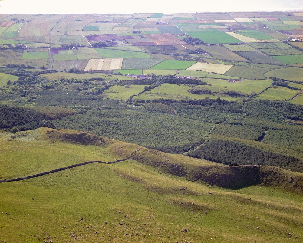
| Caption: | Upper Ballyleighery Townland. Looking W. |
| Description: | Upper Ballyleighery Townland. Looking W. Geomorphology from Binevenagh to Magilligan. The lower two-thirds of the photograph shows the hummocky ground resulting from the landslipping around Binevenagh Mountain. The distinctive ridge in the foreground may be glacial moraine. The flat area of Magilligan and Lough Foyle makes up the top of the photograph. |
| Date taken: | Wed Jan 01 00:00:00 GMT 1975 |
| Photographer: | Pulsford, J.M. |
| Copyright statement: | NERC |
| X longitude/easting: | 268700 |
| Y latitude/northing: | 430900 |
| Coordinate reference system, ESPG code: | 2157 (IRENET95 / Irish Transverse Mercator) |
| Orientation: | Landscape |
| Size: | 558.81 KB; 1001 x 803 pixels; 85 x 68 mm (print at 300 DPI); 265 x 212 mm (screen at 96 DPI); |
| Average Rating: | Not yet rated |
| Categories: | Special collections/ Northern Ireland/ Londonderry |
Loading...
Loading...
Reviews
There is currently no feedback