| P number: | P002061 |
|---|---|
| Old photograph number: | C01141 |
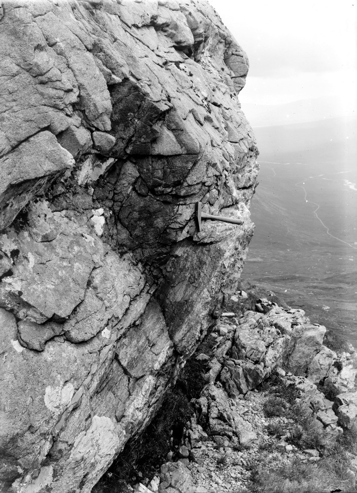
| Caption: | Stob Mhic Mhartuin, 1.6 km. north-north-west of Altnafeadh, Glen Coe. A section of the Glencoe Boundary Fault separating the main Glencoe Fault Intrusion from the bedded quartzites. |
| Description: | Stob Mhic Mhartuin, 1.6 km. north-north-west of Altnafeadh, Glen Coe. A section of the Glencoe Boundary Fault separating the main Glencoe Fault Intrusion from the bedded quartzites. The fault separates the main Glencoe Fault Intrusion (top left) from bedded quartzites (bottom right). The Fault Intrusion, here a porphyritic microdiorite, is chilled against the fault zone which consists of brecciated quartzite in a streaky banded matrix of dark glassy material (pseudotachylite). The triturated quartzite is one that has undergone comminution, i.e. the reduction of the substance to a fine powder or dust by crushing, grinding or rubbing, in this case by the emplacement of the Fault Intrusion. |
| Date taken: | Fri Jan 01 00:00:00 GMT 1904 |
| Photographer: | Lunn, R. |
| Copyright statement: | Crown |
| Acknowledgment: | This image was digitized with grant-in-aid from SCRAN the Scottish Cultural Resources Access Network |
| X longitude/easting: | 220500 |
| Y latitude/northing: | 757500 |
| Coordinate reference system, ESPG code: | 27700 (OSGB 1936 / British National Grid) |
| Orientation: | Portrait |
| Size: | 305.99 KB; 725 x 1001 pixels; 61 x 85 mm (print at 300 DPI); 192 x 265 mm (screen at 96 DPI); |
| Average Rating: | Not yet rated |
| Categories: | Unsorted Images, Geoscience subjects/ Structural features/ Faulting |
Loading...
Loading...
Reviews
There is currently no feedback