| P number: | P002050 |
|---|---|
| Old photograph number: | C00895 |
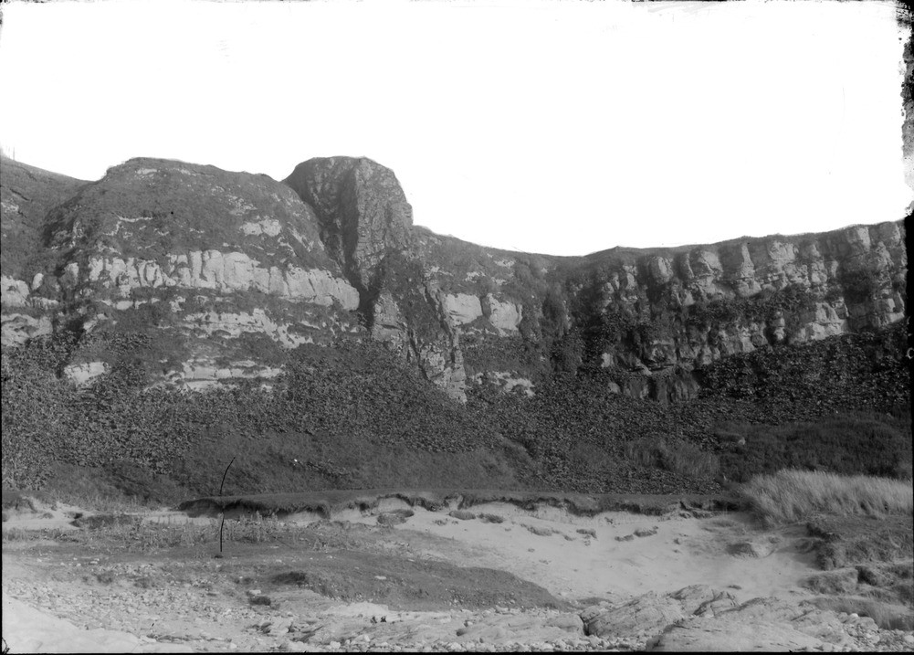
| Caption: | Shore cliff, 3.2 km. west-south-west of West Machrihanish, 9.6 km. west of Campbeltown, Kintyre, Argyllshire. Basalt dyke cutting Upper Old Red Sandstone and cornstone. |
| Description: | Shore cliff, 3.2 km. west-south-west of West Machrihanish, 9.6 km. west of Campbeltown, Kintyre, Argyllshire. Basalt dyke cutting Upper Old Red Sandstone and cornstone. This 7.6 m. wide basalt (olivine dolerite) dyke cuts sub-horizontal Upper Old Red Sandstone and cornstone (Kinnesswood Formation, Carboniferous). The more resistant nature of the basalt means that the dyke stands up as a positive feature above the softer sedimentary rocks. These rocks lie on the southern margin of the Machrihanish Basin, an isolated outlier of Carboniferous rocks on the west coast of the Kintyre peninsula. Coal was previously mined here for over two centuries. |
| Date taken: | Mon Jan 01 00:00:00 GMT 1900 |
| Photographer: | Lunn, R. |
| Copyright statement: | Crown |
| Acknowledgment: | This image was digitized with grant-in-aid from SCRAN the Scottish Cultural Resources Access Network |
| X longitude/easting: | 161500 |
| Y latitude/northing: | 619500 |
| Coordinate reference system, ESPG code: | 27700 (OSGB 1936 / British National Grid) |
| Orientation: | Landscape |
| Size: | 184.94 KB; 1001 x 717 pixels; 85 x 61 mm (print at 300 DPI); 265 x 190 mm (screen at 96 DPI); |
| Average Rating: | Not yet rated |
| Categories: | Unsorted Images, Geoscience subjects/ Igneous features/ Dykes |
Loading...
Loading...
Reviews
There is currently no feedback