| P number: | P002046 |
|---|---|
| Old photograph number: | C00874 |
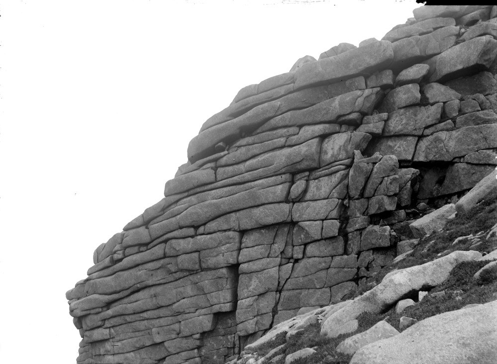
| Caption: | Summit of Goat Fell, Isle of Arran, Buteshire. Typical upland granite topography. |
| Description: | Summit of Goat Fell, Isle of Arran, Buteshire. Typical upland granite topography. Characteristic jointing in the coarser granite, causing it to break up into slabs and weather into 'tors' (isolated upright crags with deep weathering along joints, giving a somewhat rounded appearance). Arran is one of the series of Tertiary volcanic centres grouped along the west coast of Scotland and relates to a period of crustal extension between 55 and 61 million years ago. Similar aged lavas and intrusions in the Faeroes and East Greenland were all once part of the same Tertiary igneous province, before being separated by the opening of the Atlantic Ocean. |
| Date taken: | Mon Jan 01 00:00:00 GMT 1900 |
| Photographer: | Lunn, R. |
| Copyright statement: | Crown |
| Acknowledgment: | This image was digitized with grant-in-aid from SCRAN the Scottish Cultural Resources Access Network |
| X longitude/easting: | 199500 |
| Y latitude/northing: | 641500 |
| Coordinate reference system, ESPG code: | 27700 (OSGB 1936 / British National Grid) |
| Orientation: | Landscape |
| Size: | 163.09 KB; 1000 x 732 pixels; 85 x 62 mm (print at 300 DPI); 265 x 194 mm (screen at 96 DPI); |
| Average Rating: | Not yet rated |
| Categories: | Unsorted Images, Geoscience subjects/ Landforms, weathering/ Rock weathering, Geoscience subjects/ Landforms, weathering/ Weathering along bedding. Joints, cleavage |
Loading...
Loading...
Reviews
There is currently no feedback