| P number: | P002034 |
|---|---|
| Old photograph number: | C00763 |
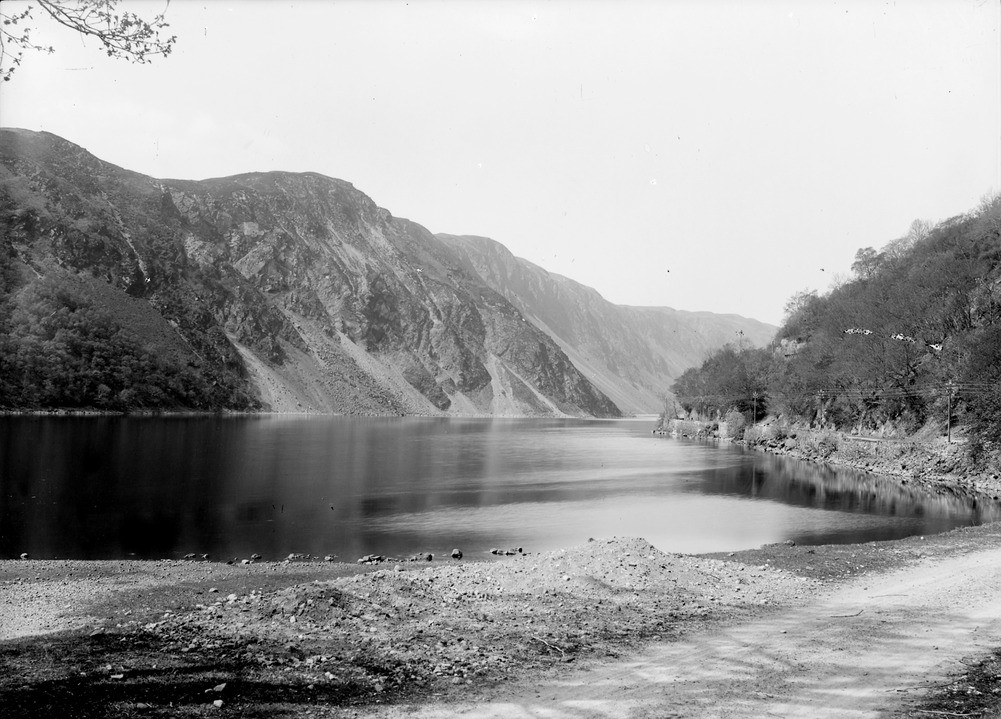
| Caption: | Creag an Aoineidh and the Pass of Brander, 9.6 km. west of Dalmally, Argyllshire. |
| Description: | The Pass of Brander fault is poorly exposed, it forms an arcuate structure that can be traced as far as the Ballachullish granite. The fault downthrows to the south-west with a minimum displacement of 1.3 km. Steep scarp, with talus features, produced by a fault running along the Pass of Brander. The rocks are Dalradian metasedimentary rocks with minor porphyrite and epidiorite dykes. |
| Date taken: | Sun Jan 01 00:00:00 GMT 1905 |
| Photographer: | Lunn, R. |
| Copyright statement: | Crown |
| Acknowledgment: | This image was digitized with grant-in-aid from SCRAN the Scottish Cultural Resources Access Network |
| X longitude/easting: | 205500 |
| Y latitude/northing: | 727500 |
| Coordinate reference system, ESPG code: | 27700 (OSGB 1936 / British National Grid) |
| Orientation: | Landscape |
| Size: | 201.76 KB; 1001 x 719 pixels; 85 x 61 mm (print at 300 DPI); 265 x 190 mm (screen at 96 DPI); |
| Average Rating: | Not yet rated |
| Categories: | Unsorted Images, Geoscience subjects/ Landforms, river/ Valleys, Geoscience subjects/ Landforms, river/ Valleys controlled by faults and shatter belts |
Loading...
Loading...
Reviews
There is currently no feedback