| P number: | P225063 |
|---|---|
| Old photograph number: | NI00380 |
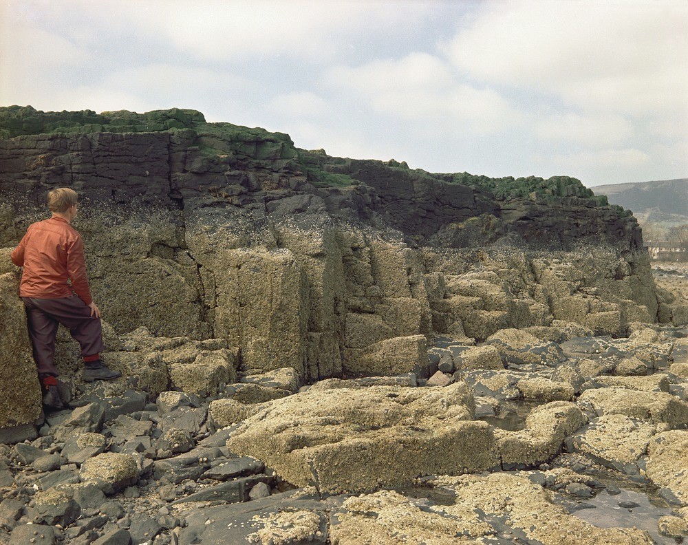
| Caption: | Greenisland near Carrickfergus. Looking SW. |
| Description: | Greenisland near Carrickfergus. Looking SW. Greenisland sill intruded into Keuper Marl. The sill occurs on the foreshore as an island linked to the mainland at low tide. Platy jointing parallel to the upper surface is well-developed at the top above the shellfish zone. Columnar jointing is present below this. |
| Date taken: | Sun Apr 01 00:00:00 BST 1962 |
| Photographer: | Pulsford, J.M. |
| Copyright statement: | Crown |
| X longitude/easting: | 338800 |
| Y latitude/northing: | 385200 |
| Coordinate reference system, ESPG code: | 2157 (IRENET95 / Irish Transverse Mercator) |
| Orientation: | Landscape |
| Size: | 572.96 KB; 1000 x 792 pixels; 85 x 67 mm (print at 300 DPI); 265 x 210 mm (screen at 96 DPI); |
| Average Rating: | Not yet rated |
| Categories: | Special collections/ Northern Ireland/ Antrim, Geoscience subjects/ Igneous features/ Sills |
Loading...
Loading...
Reviews
There is currently no feedback