| P number: | P002027 |
|---|---|
| Old photograph number: | C00631 |
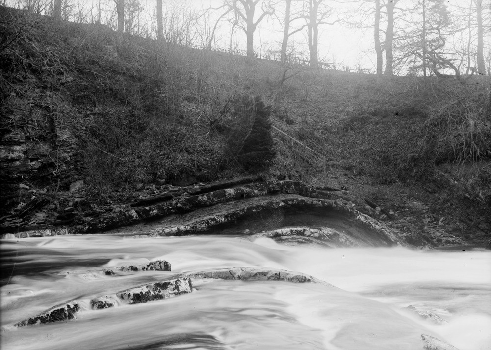
| Caption: | Penton Linns, Liddel Water, about 100 m. downstream from Penton Bridge and 4.0 km. east-north-east of Canonbie, Dumfries and Galloway. Asymmetrical anticline in Carboniferous limestones and shales. |
| Description: | Penton Linns, Liddel Water, about 100 m. downstream from Penton Bridge and 4.0 km. east-north-east of Canonbie, Dumfries and Galloway. Asymmetrical anticline in Carboniferous limestones and shales. This is the well-known Penton Anticline, a sharp anticline in the Penton Limestone (Lower Carboniferous). The anticline plunges gently southwards and is markedly asymmetrical. The eastern limb (upstream, on left) dips about 20 degrees to the east-south-east whereas the western limb (downstream, on right) dips about 60 degrees towards the west. The Carboniferous rocks in the Canonbie area form part of the northern limb of the Northumberland Basin, an extensive area or Carboniferous rocks which straddles the border region between Scotland and England. |
| Date taken: | Fri Jan 01 00:00:00 GMT 1897 |
| Photographer: | Lunn, R. |
| Copyright statement: | Crown |
| Acknowledgment: | This image was digitized with grant-in-aid from SCRAN the Scottish Cultural Resources Access Network |
| X longitude/easting: | 343500 |
| Y latitude/northing: | 577500 |
| Coordinate reference system, ESPG code: | 27700 (OSGB 1936 / British National Grid) |
| Orientation: | Landscape |
| Size: | 226.24 KB; 1001 x 714 pixels; 85 x 60 mm (print at 300 DPI); 265 x 189 mm (screen at 96 DPI); |
| Average Rating: | Not yet rated |
| Categories: | Unsorted Images, Geoscience subjects/ Structural features/ Folding |
Loading...
Loading...
Reviews
There is currently no feedback