| P number: | P225036 |
|---|---|
| Old photograph number: | NI00353 |
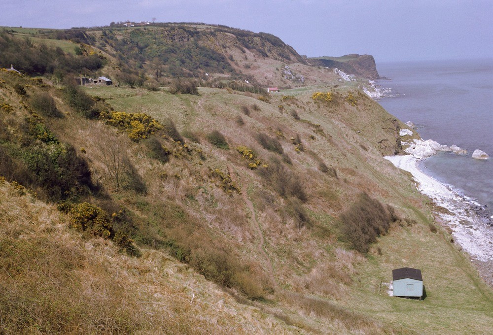
| Caption: | Hillhead, Islandmagee. Looking NNW. |
| Description: | Hillhead, Islandmagee. Looking NNW. Coastal landslip topography, Islandmagee. Jumbled mass of Cretaceous rocks and Lower Basalts resting on Keuper Marl at depth. Slips have occurred on wet Rhaetic-Lias clays and Keuper Marl. |
| Date taken: | Sun Apr 01 00:00:00 BST 1962 |
| Photographer: | Pulsford, J.M. |
| Copyright statement: | Crown |
| X longitude/easting: | 348500 |
| Y latitude/northing: | 395500 |
| Coordinate reference system, ESPG code: | 2157 (IRENET95 / Irish Transverse Mercator) |
| Orientation: | Landscape |
| Size: | 495.32 KB; 1000 x 680 pixels; 85 x 58 mm (print at 300 DPI); 265 x 180 mm (screen at 96 DPI); |
| Average Rating: | Not yet rated |
| Categories: | Special collections/ Northern Ireland/ Antrim |
Loading...
Loading...
Reviews
There is currently no feedback