| P number: | P002019 |
|---|---|
| Old photograph number: | C00483 |
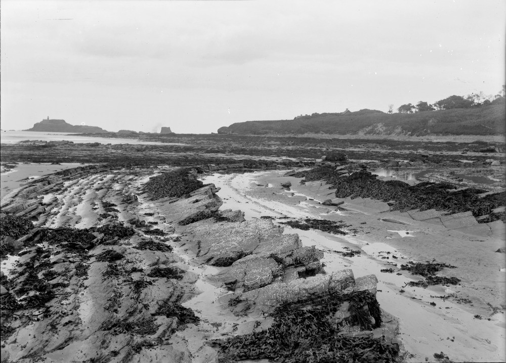
| Caption: | Shore, 0.5 km. west of Weaklaw, 5.3 km. west of North Berwick, East Lothian. Wave-cut platform in Carboniferous strata. |
| Description: | Shore, 0.5 km. west of Weaklaw, 5.3 km. west of North Berwick, East Lothian. Wave-cut platform in Carboniferous strata. Carboniferous strata dipping seawards (to the north) with axis of syncline somewhere off to the left. The island of Fidra (with lighthouse), can be seen in the right background. Although no contacts can be seen, the dolerite has vertical cooling columns, suggesting that the island is probably part of a sill. The headland in the right background consists of agglomerates and trachytes. Cyclic sedimentation is a very common feature of the Carboniferous, here well displayed in the Cementstone facies, thinly-bedded fine-grained dolomitic limestones alternating with shales. They probably represent original deposition in a restricted lagoonal environment. |
| Date taken: | Fri Jan 01 00:00:00 GMT 1904 |
| Photographer: | Lunn, R. |
| Copyright statement: | Crown |
| Acknowledgment: | This image was digitized with grant-in-aid from SCRAN the Scottish Cultural Resources Access Network |
| X longitude/easting: | 349500 |
| Y latitude/northing: | 685500 |
| Coordinate reference system, ESPG code: | 27700 (OSGB 1936 / British National Grid) |
| Orientation: | Landscape |
| Size: | 214.45 KB; 1000 x 718 pixels; 85 x 61 mm (print at 300 DPI); 265 x 190 mm (screen at 96 DPI); |
| Average Rating: | Not yet rated |
| Categories: | Unsorted Images, Geoscience subjects/ Landforms, marine/ Wave-cut platforms, reefs and foreshores |
Loading...
Loading...
Reviews
There is currently no feedback