| P number: | P002016 |
|---|---|
| Old photograph number: | C00480 |
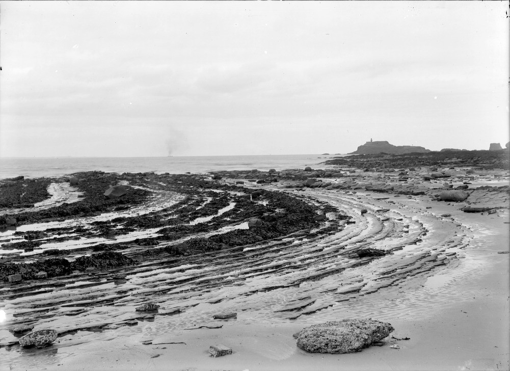
| Caption: | Shore, 0.5 km. west of Weaklaw, 5.3 km. west of North Berwick, East Lothian. Wave-cut platform in Carboniferous strata. |
| Description: | Shore, 0.5 km. west of Weaklaw, 5.3 km. west of North Berwick, East Lothian. Wave-cut platform in Carboniferous strata. The sea has planed off the rocks to give a section through folded Carboniferous sedimentary rocks, displaying the characteristic cyclic sedimentation pattern in the Cementstone facies. The strata are folded into a syncline on the left and centre, giving way to a complementary dome to the right. The island of Fidra, probably part of a dolerite sill, can be seen in the right background (with lighthouse). Shore sections commonly provide excellent exposures of rock, allowing strata to be carefully examined and structural data recorded. One drawback is the necessity to consider the times of tides from the point of view of both safety and access. |
| Date taken: | Fri Jan 01 00:00:00 GMT 1904 |
| Photographer: | Lunn, R. |
| Copyright statement: | Crown |
| Acknowledgment: | This image was digitized with grant-in-aid from SCRAN the Scottish Cultural Resources Access Network |
| X longitude/easting: | 349500 |
| Y latitude/northing: | 685500 |
| Coordinate reference system, ESPG code: | 27700 (OSGB 1936 / British National Grid) |
| Orientation: | Landscape |
| Size: | 191.44 KB; 1001 x 728 pixels; 85 x 62 mm (print at 300 DPI); 265 x 193 mm (screen at 96 DPI); |
| Average Rating: | Not yet rated |
| Categories: | Unsorted Images, Geoscience subjects/ Landforms, marine/ Wave-cut platforms, reefs and foreshores, Geoscience subjects/ Structural features/ Folding |
Loading...
Loading...
Reviews
There is currently no feedback