| P number: | P224920 |
|---|---|
| Old photograph number: | NI00226 |
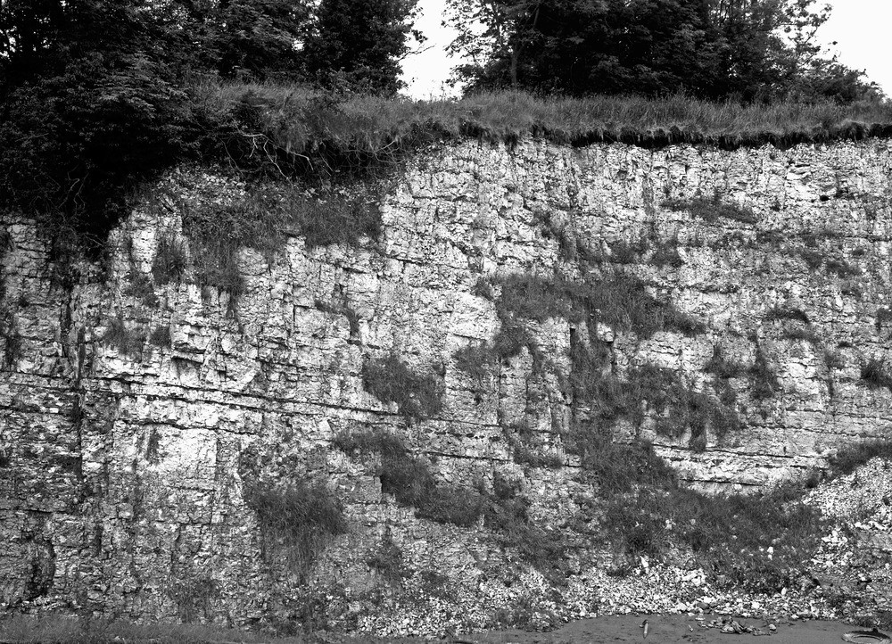
| Caption: | Mullaghcarton Limeworks (T. Hull) Quarry 1720 yd. at N. 61 degrees E. of Maghaberry crossroads. Looking WSW. |
| Description: | Mullaghcarton Limeworks (T. Hull) Quarry 1720 yd. at N. 61 degrees E. of Maghaberry crossroads. Looking WSW. Quarry in the Upper Chalk at Mullaghcarton, Co. Antrim. The quarry exhibits practically the full sequence of Senonian Chalk in this area. The 'Green Bed' horizon is about half-way up the face. Trias shales are exposed in a trench and tunnel leading off extreme bottom left-hand corner of photograph. |
| Date taken: | Wed Jun 01 00:00:00 BST 1955 |
| Photographer: | Rhodes, J. |
| Copyright statement: | Crown |
| Orientation: | Landscape |
| Size: | 440.31 KB; 1000 x 722 pixels; 85 x 61 mm (print at 300 DPI); 265 x 191 mm (screen at 96 DPI); |
| Average Rating: | Not yet rated |
| Categories: | Special collections/ Northern Ireland/ Antrim |
Loading...
Loading...
Reviews
There is currently no feedback